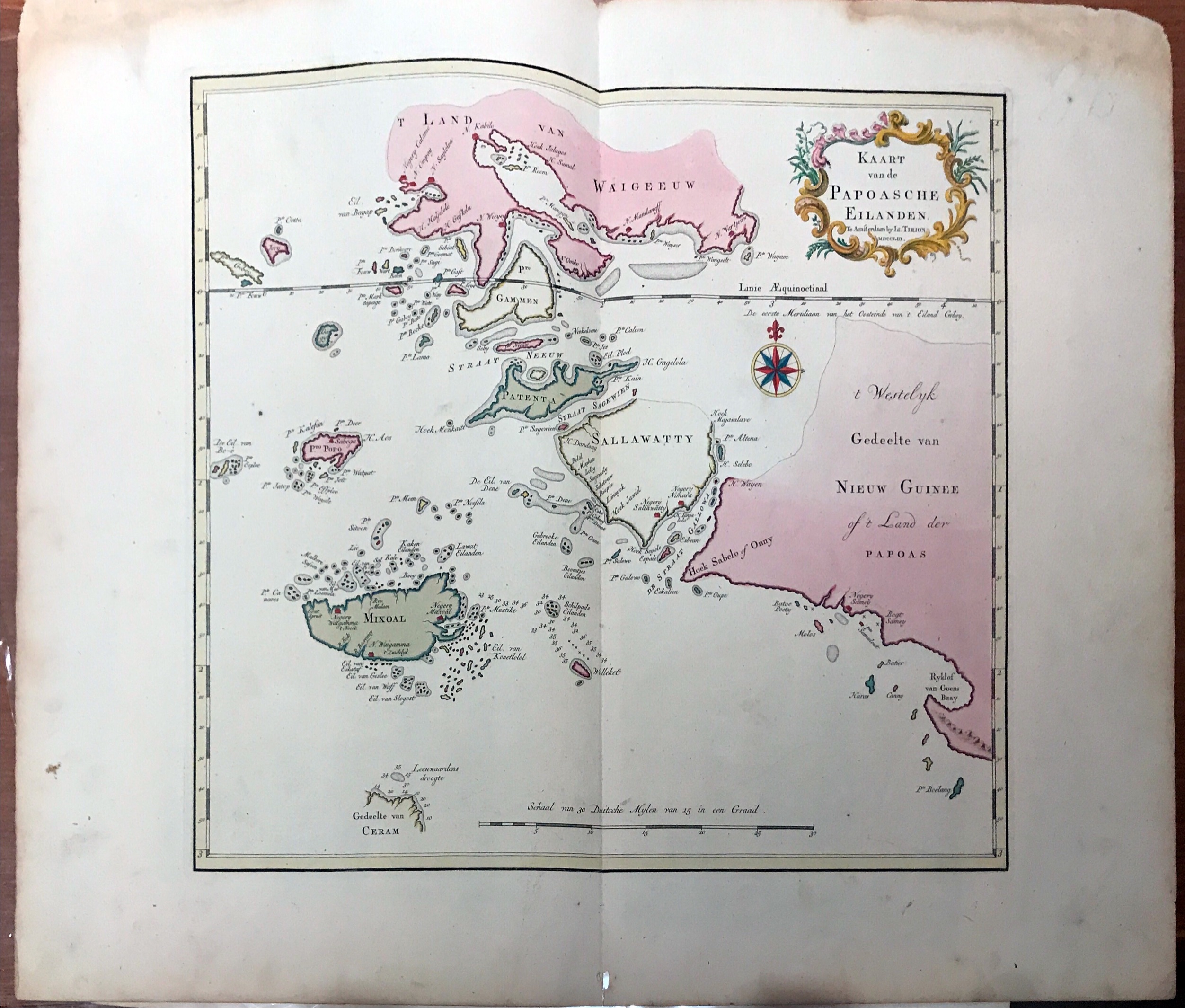
Map of Papua and the Eastern New Guinea – Tirion (1744)
Antique Map of now-called Papua island and the eastern islands of New Guinea titled ‘Kaart van de Papoasche Eilanden’ by Isaak Tirion.
Antique Map of now-called Papua island and the eastern islands of New Guinea titled ‘Kaart van de Papoasche Eilanden’ by Isaak Tirion.
The Portuguese Jorge de Meneses, who explored the north coast and offshore islands in 1526/27, is considered the island’s European explorer. In 1545 the Spaniard Íñigo Ortiz de Retez landed and named the island “New Guinea” because the coast reminded him of that of the African Guinea, which he had previously passed. In 1623 Jan Carstenszoon mapped large parts of the coast on behalf of the Dutch East India Company. Since then, the Dutch East India Company has maintained business and political contacts with the region and the Sultanate of Tidore.
Artist and Engravers : Isaak Tirion (1705 – 1765) was a Dutch book dealer and publisher. He is well known for his Hedendaagsche historie (Modern History) and his Vaderlandse Historie both historical reference works that were illustrated with engravings by leading artists of Amsterdam, 1705.
Conditions: Fair, brown toning on the side, and tear but not affecting the image.
Measurements: 500 x 400 mm
Purchase code: BG-11761