Jakarta Collection
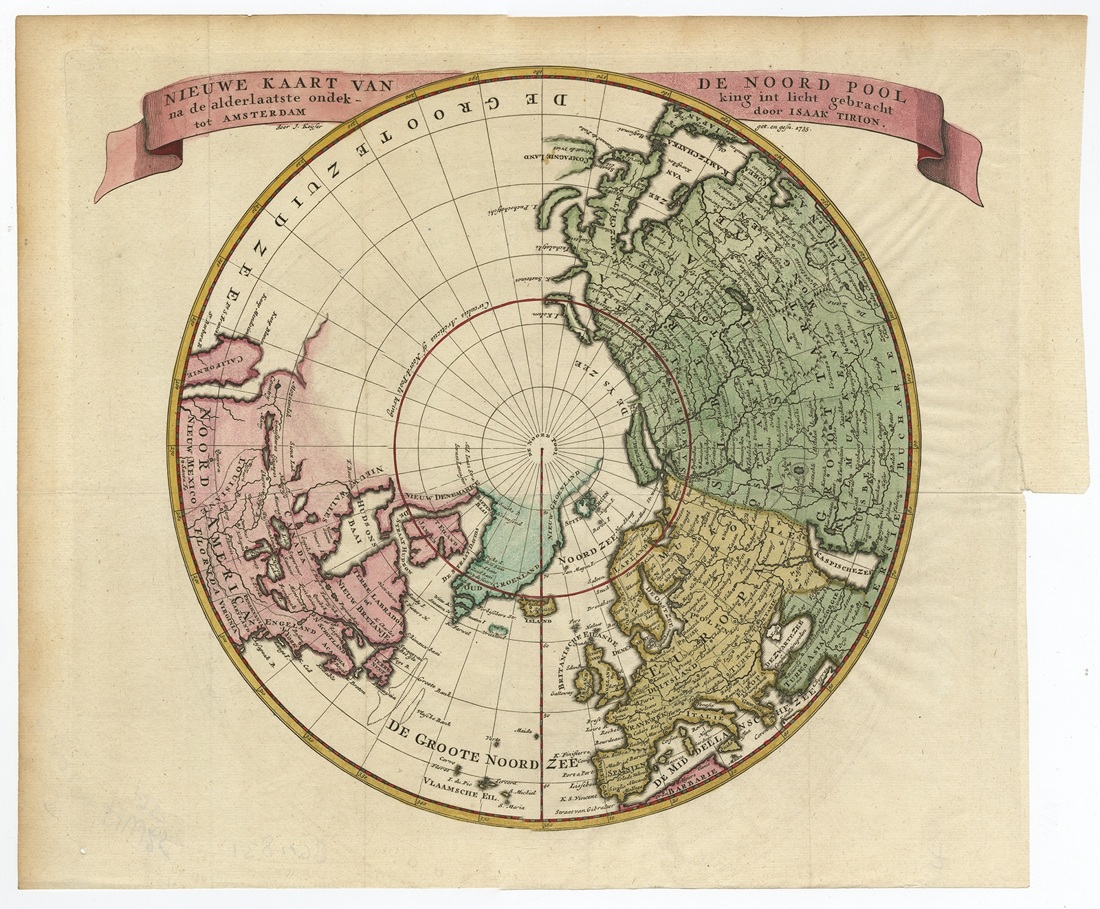
Nieuwe Kaart van de Noord Pool (..) – Tirion (c.1750)
Description: Antique print, titled: ‘Nieuwe Kaart van de Noord Pool na de alderlaatste ondekking int licht gebracht’ – Map of the Northern Hemisphere and North Pole, which shows the NE Passage, but no definite NW Passage. California is shown as an Island, along with the River systems of North America. Nice detail in the Polar regins, especially New Denmark and Greenland and in Asia and Europe.
Source unknown, to be determined.
Artists and Engravers: Made by ‘Isaak Tirion’ after an anonymous artist. Isaak Tirion, a Dutch publisher in Amsterdam, was born 1705. He produced serveral Atlases and Dutch town plans. The maps mainly based on those of Guillaume de l’Isle. He died in 1765.
- Date: 1750
- Technic: Engraving / etching with hand colouring on hand laid paper.
- Overall size: 14,8 x 12,7 inch
- Image size: 13 x 11 inch
- Condition: Good, given age. Small hole bottom left corner, outside image area. Original folds as issued. General age-related toning and/or occasional minor defects from handling. Please study scan carefully.
- PartNumber: PCT-58795
- Storage Location: BG-B6-07 Iscra
- Price : 445 Euro / 530 USD / 7.600.000 IDR


