Jakarta Collection
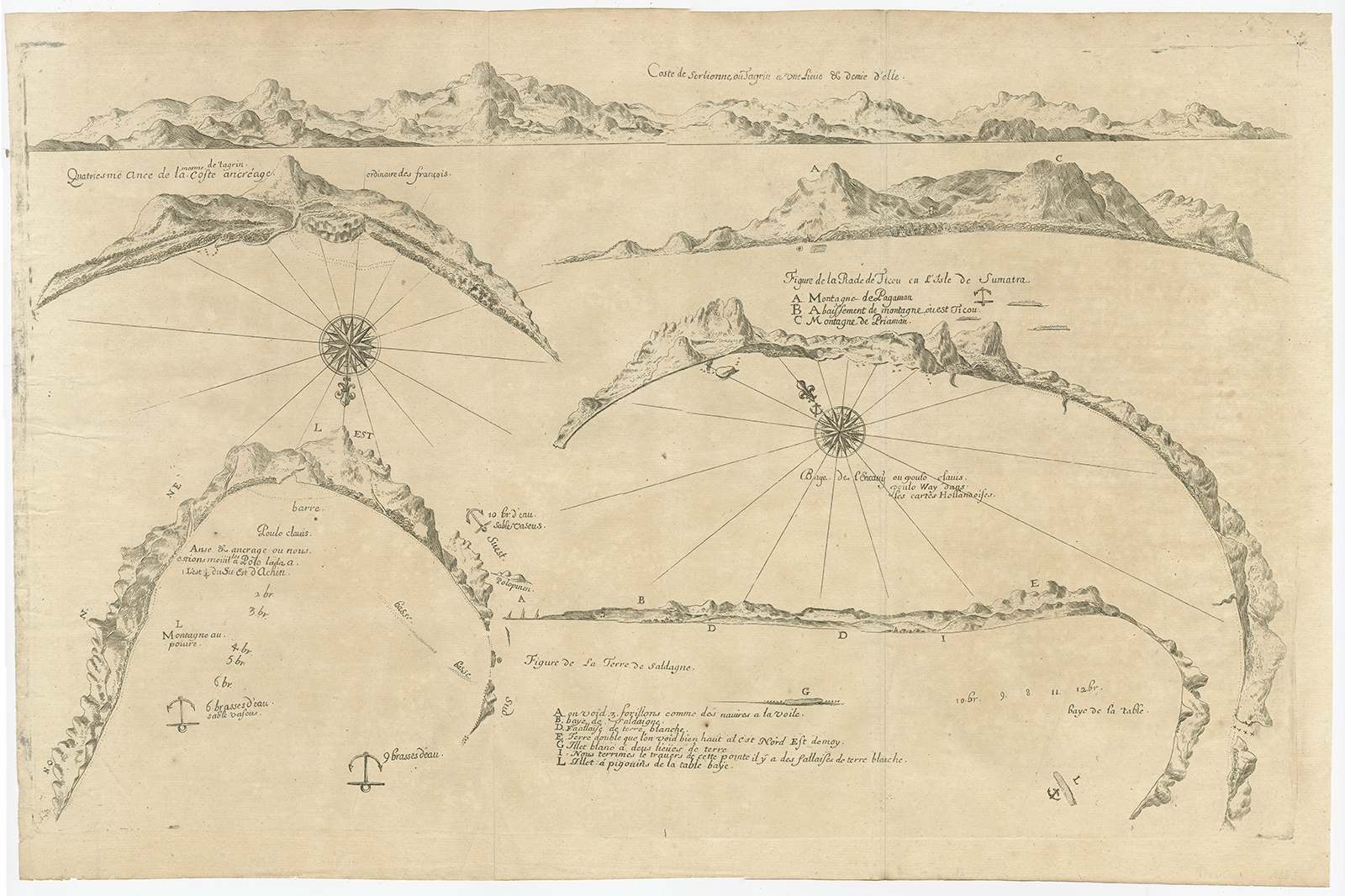
Untitled Chart of Table Bay and the Bay of Saldagne -Thevenot (c.1660)
Description: This rare antique map includes six coastal elevation views of anchorages and bays favored by Dutch and French vessels on their way to Asia. Two views of the coast of Sierra Leone, Africa ‘Tagrin’ opposite Freetown. A view of the coast of Aceh on the northern coast of Sumatra and a further unidentified anchorage ‘Baye de l’Encau’. A view of the African coast including the Bay of Saldagne and Table Bay. A coastal view at Tiku in West Sumatra.
Artists and Engravers: Melchisédech (or Melchisédec) Thévenot (c. 1620 – 1692) was a French author, scientist, traveler, and cartographer.
- Date: c.1660
- Overall size: 54 x 35.5 cm.
- Image size: 51.5 x 31 cm.
- Condition: Very good, general age-related toning. Please study image carefully.
- Purchase code : BG-00737
- Price : 519,5 Euro / 619,5 USD / 8.950.000 IDR