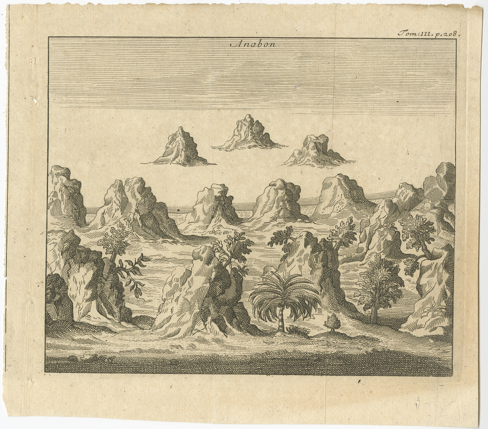
Anabon – Anonymous (c.1740)
Product Information
Product code: BG-09136€97,50
Description:Â Antique print Ambon titled ‘Anabon’. Antique print of the island of Ambon, Indonesia. Source unknown, to be determined.
Artists and Engravers:Â Anonymous.
- Date: c.1740
- Overall size: 19 x 17 cm.
- Image size: 16.5 x 13.5 cm.
- Condition: Good, general age-related toning. Minor defects, please study image carefully.
1 in stock
Tags: Indonesia, Asia, Southeast Asia, Antique Maps, Plans & Charts.
Social
Description
Description
Description:Â Antique print Ambon titled ‘Anabon’. Antique print of the island of Ambon, Indonesia. Source unknown, to be determined.
Artists and Engravers:Â Anonymous.
- Date: c.1740
- Overall size: 19 x 17 cm.
- Image size: 16.5 x 13.5 cm.
- Condition: Good, general age-related toning. Minor defects, please study image carefully.
Related Products
Antique Map of the Banda Islands by Keizer & De Lat (c.1747) – SOLD
Antique map of the Banda Islands titled ‘Kaartje van de Zuid Wester Eilanden van Banda’. Rare and uncommon map of the Banda Islands, Indonesia. The map includes detailed topographical features, roads, rivers, towns, smaller islands,...
€365,00
Add to cart
Antique Map of Batavia and Surabaya by Winkler Prins, 1905
Antique map titled ‘Batavia en Soerabaja’. Detailed plan of Batavia (Jakarta) and Soerabaja (Surabaya), Indonesia. The plans include important places like Tandjoeng Priok, Oedjong, Weltevreden, Ngampel, Keta Bang, Goebeng, Koepang, Goen Sari and Wanakrama. Condition:...
€160,00
Add to cart
Antique Map of the Ternate Islands by Van den Bosch ‘1818’
Antique map titled ‘Kaart der Ternataansche Eilanden’. Rare and attractive map of the Ternate Islands with a large view of Ternate Island. One of 12 maps from ‘Atlas van Overzeesche bezittingen’ (Atlas of Oversea Possessions)...
€1.300,00
Add to cart
Antique Print of Chinese Graves by Perelaer (1888)
Antique print of Chinese graves in Batavia / Djakarta on Java, Indonesia. This print originates from ‘Het Kamerlid van Berkestein in Nederlandsch-Indië’ by M.T.H. Perelaer, published in Leiden. M.T.H. (Michel Theophile Hubert) Perelaer (Maastricht 1831 – Den...
€115,00
Add to cart
Antique Map of the East Indies by Van der Aa ‘1849’
Antique map titled ‘Kaart van Nederlands OostIndie door A.J. van der Aa’. Old map of the Dutch East Indies. This map originates from ‘Nederlands Oost-Indië, of beschrijving der Nederlandsche bezittingen in Oost-Indië, voorafgegaan door een...
€450,00
Add to cart
Antique Map of Batavia, Semarang and Surabaya by Wolters ‘circa 1910’
Antique map titled ‘Plattegronden van Steden op Java’. Old map with plans of Batavia (Jakarta), Semarang and Surabaya (Soerabaja)’. Published by J.B. Wolters. Condition: Please study images carefully. Dimensions: 25 x 16 cm.
€160,00
Add to cart