Jakarta Collection
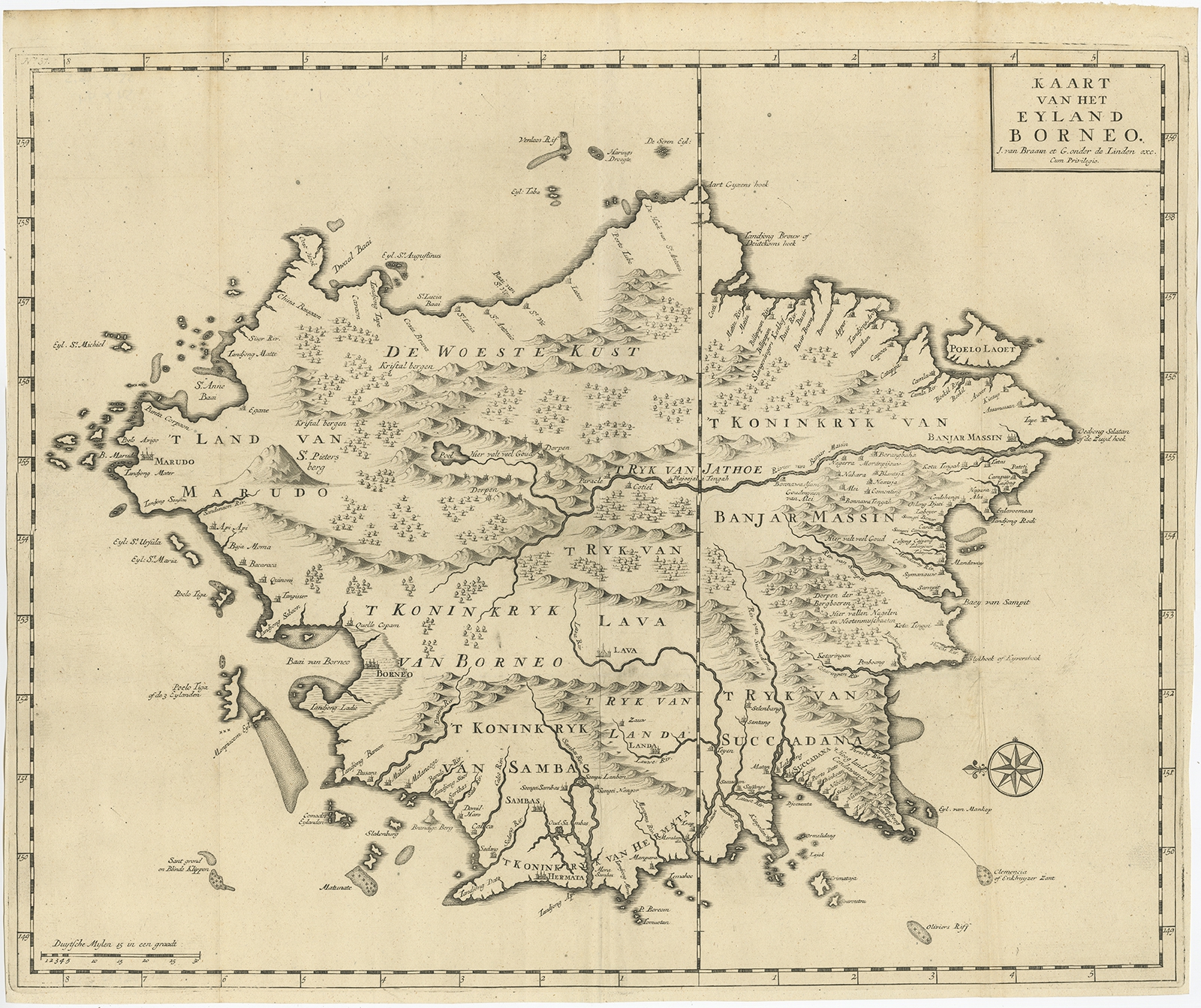
Kaart van het Eyland Borneo – Valentijn (1726)
Description: Antique map Indonesia titled ‘Kaart van het Eyland Borneo’. Early map of the Island of Borneo. This map originates from ‘Oud en Nieuw Oost-Indiën’ by F. Valentijn.
Artists and Engravers: François Valentijn (1666-1727), a missionary, worked at Amboina from 1684 to 1694 and 1705 to 1713 and travelled extensively in the VOC’s lands.
- Date: 1726
- Overall size: 55 x 46.5 cm.
- Image size: 54 x 44 cm.
- Condition: Very good, please study image carefully.