Skip to content
Maps of Asia
Dutch East Indies
Jakarta Collection
Visit Us
Contact
Shop Online Worldwide
Shop Online Worldwide
Maps of Asia
Dutch East Indies
Jakarta Collection
Visit Us
Contact
Dutch East Indies
Search
Showing 15 results
Dutch East Indies
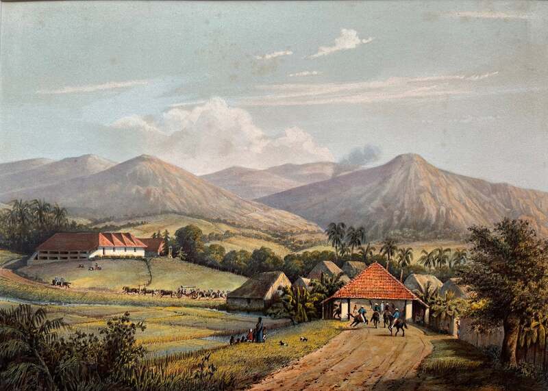
Java: Based on Paintings and Drawings by A. Salm
Dutch East Indies
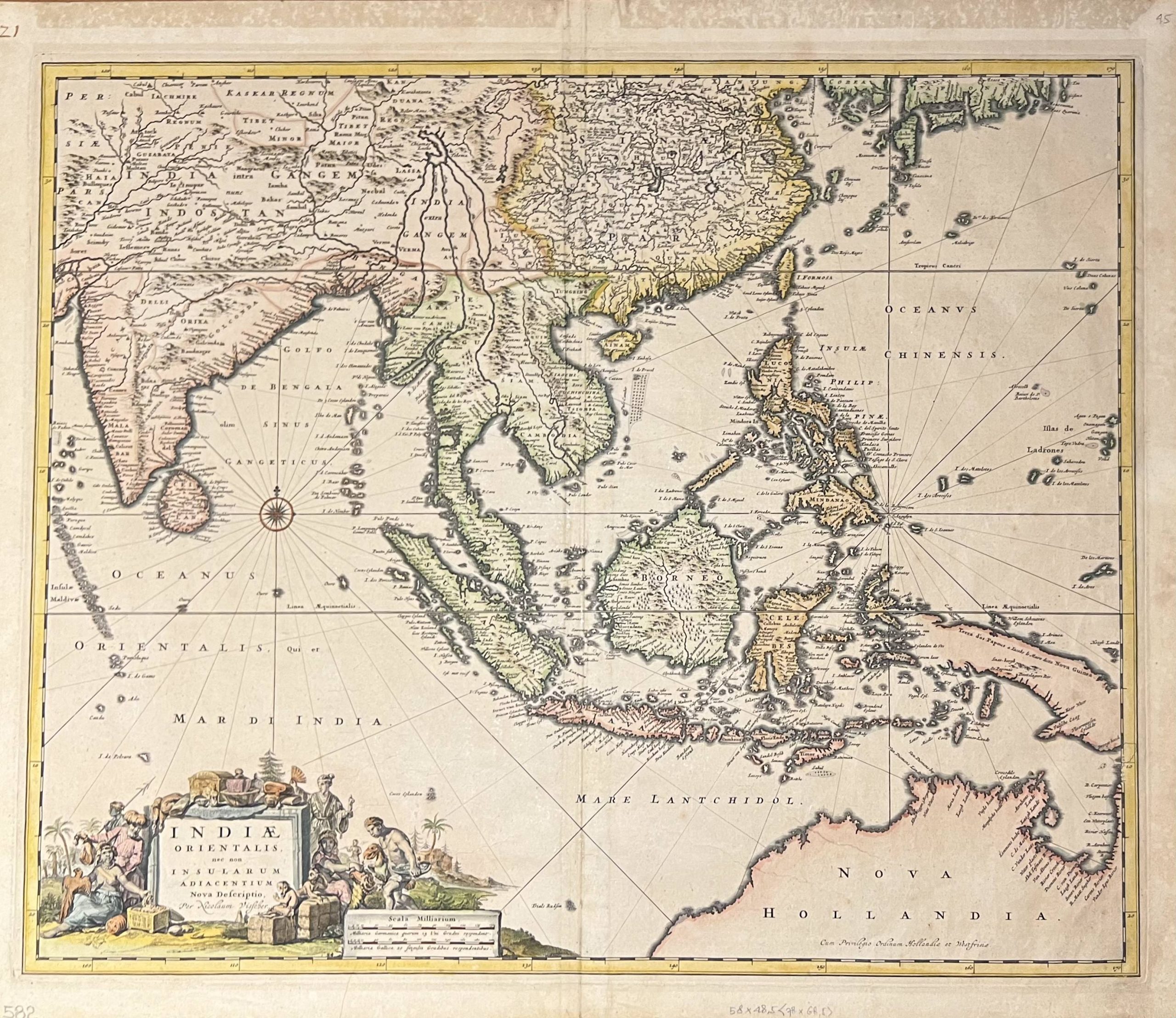
Antique Map of The East Indies by Visscher (1685)
Dutch East Indies
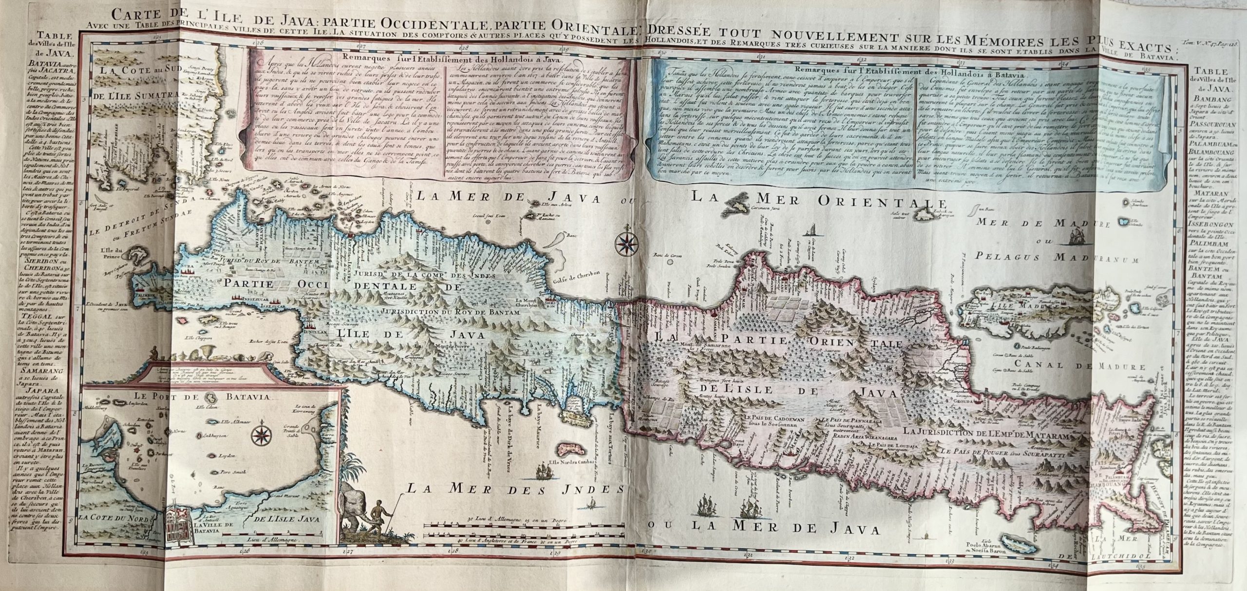
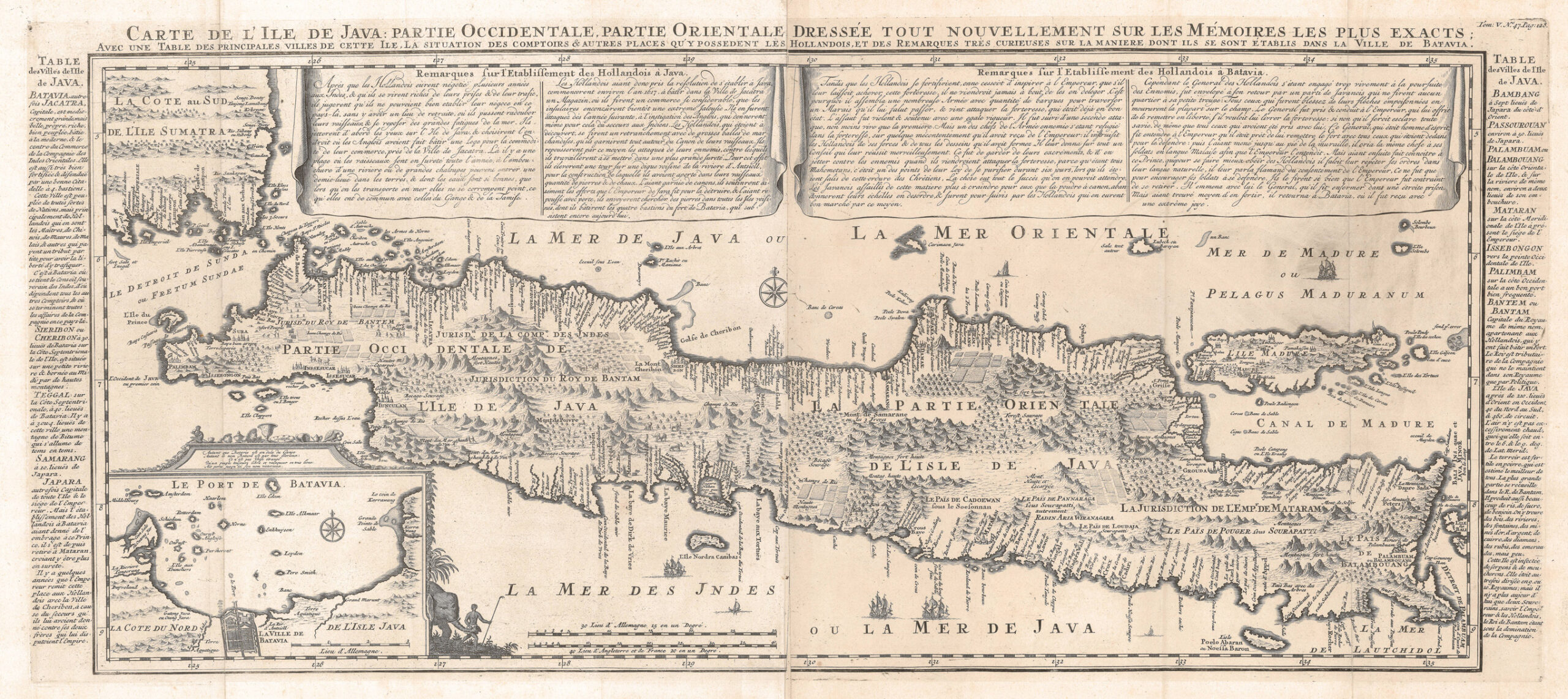
Antique Map of Java – Chatelain (c.1719)
Dutch East Indies
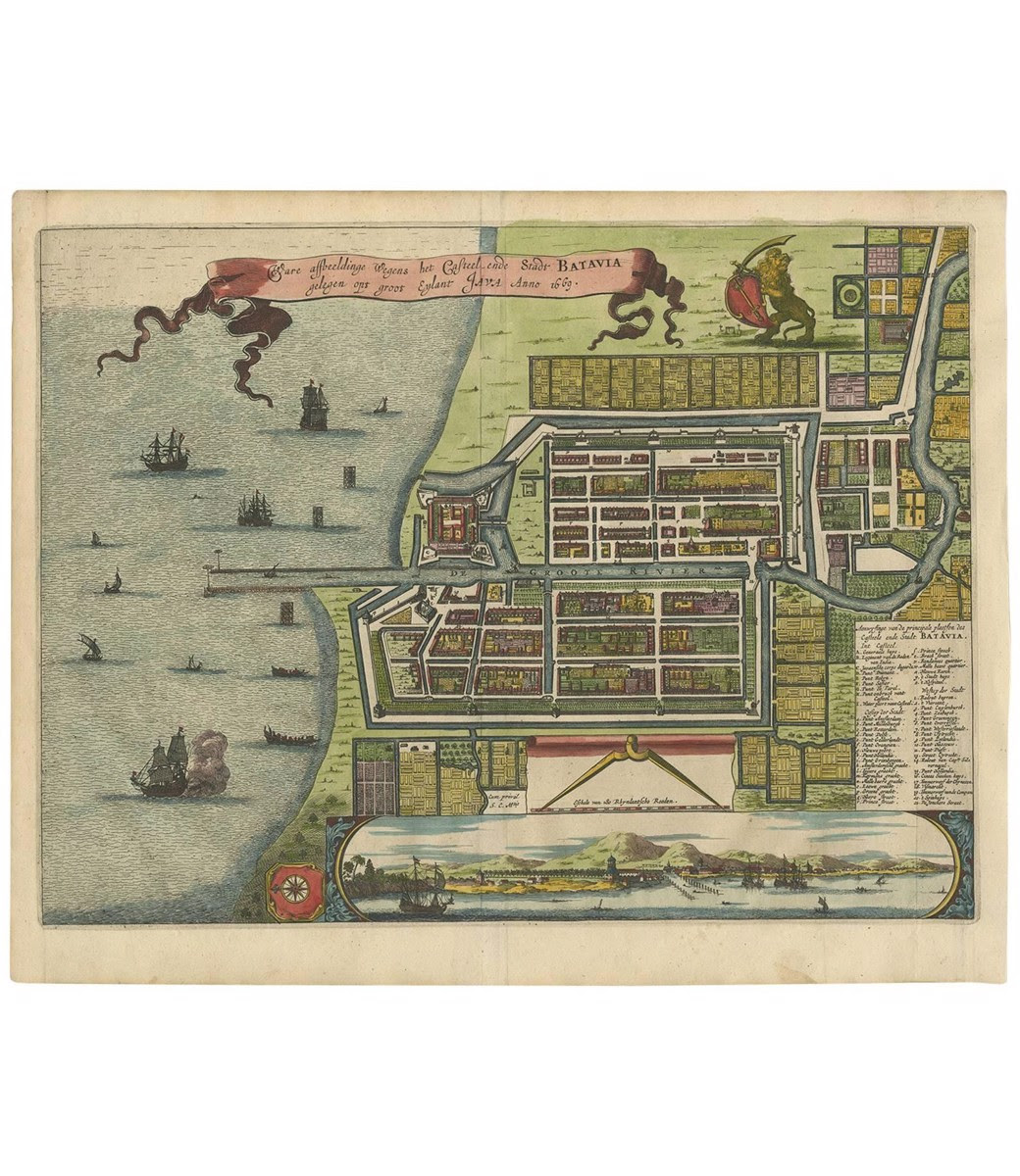
Plan of Batavia – Montanus (c.1679)
Dutch East Indies
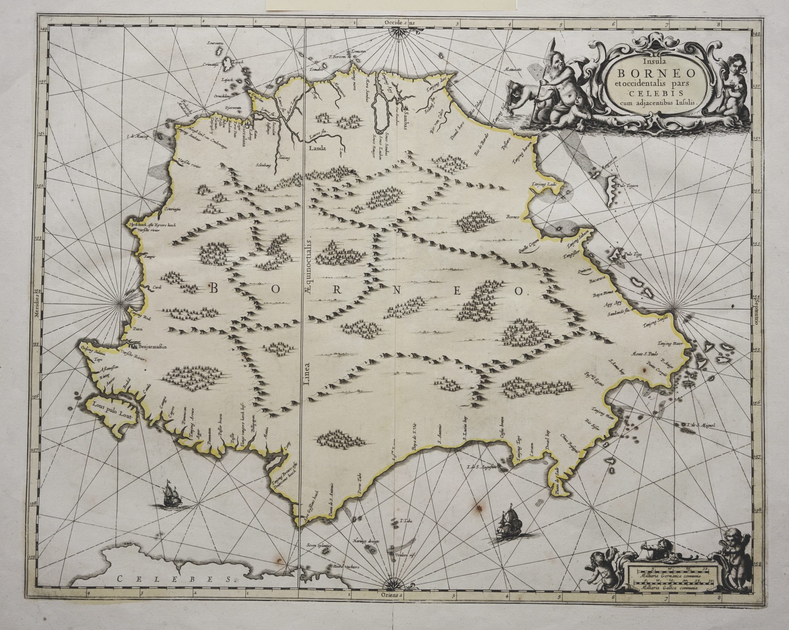
Sea Chart of Borneo – Janssonius (c.1657)
Dutch East Indies
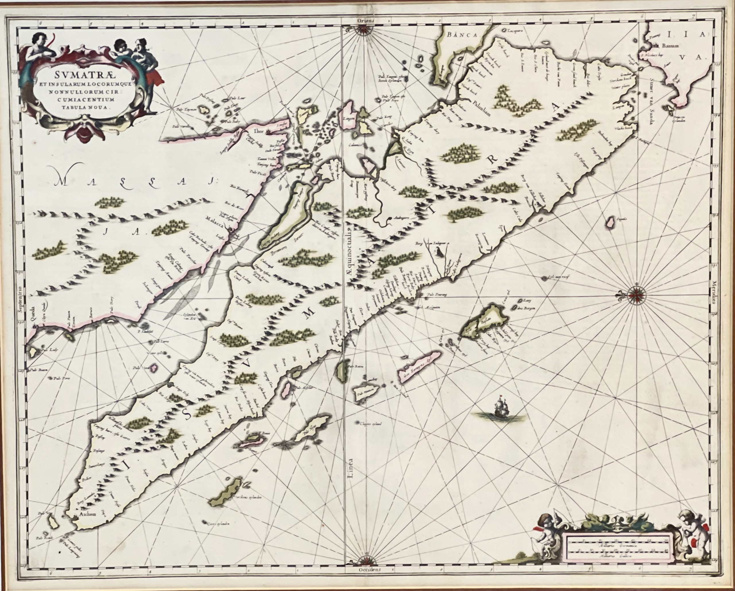
Sumatrae et Insularum – Janssonius (1657)
Dutch East Indies
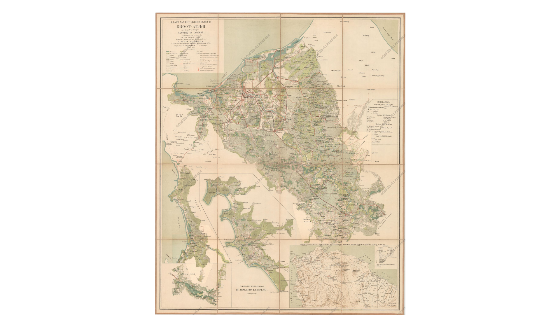
Groot Atjeh – L.W.J.K Thomson (c.1897)
Dutch East Indies
Topography Map of Semarang – Batavia Bureau (c.1872)
Dutch East Indies
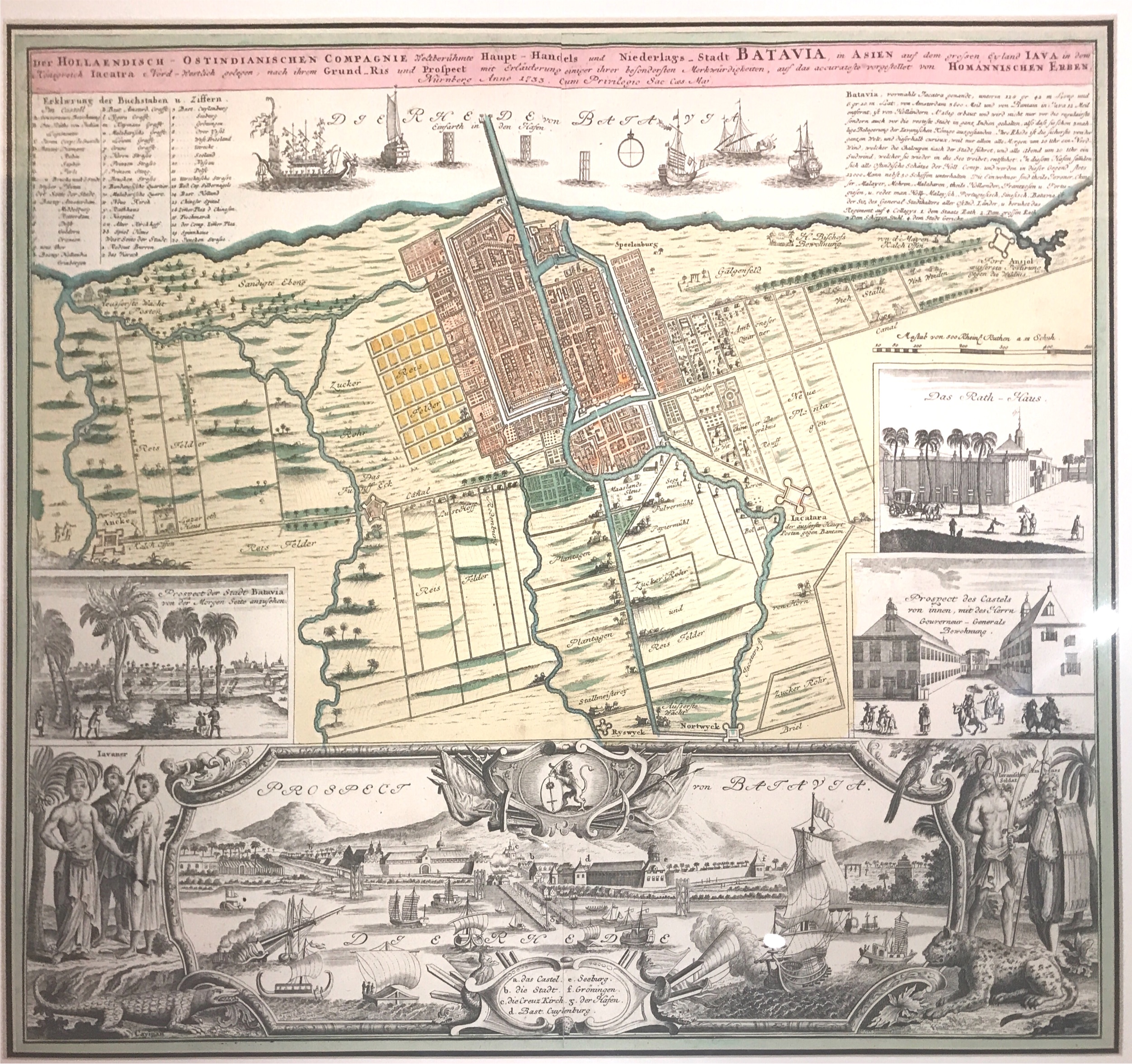
Antique Map of Batavia – Homann (c.1744)
Dutch East Indies
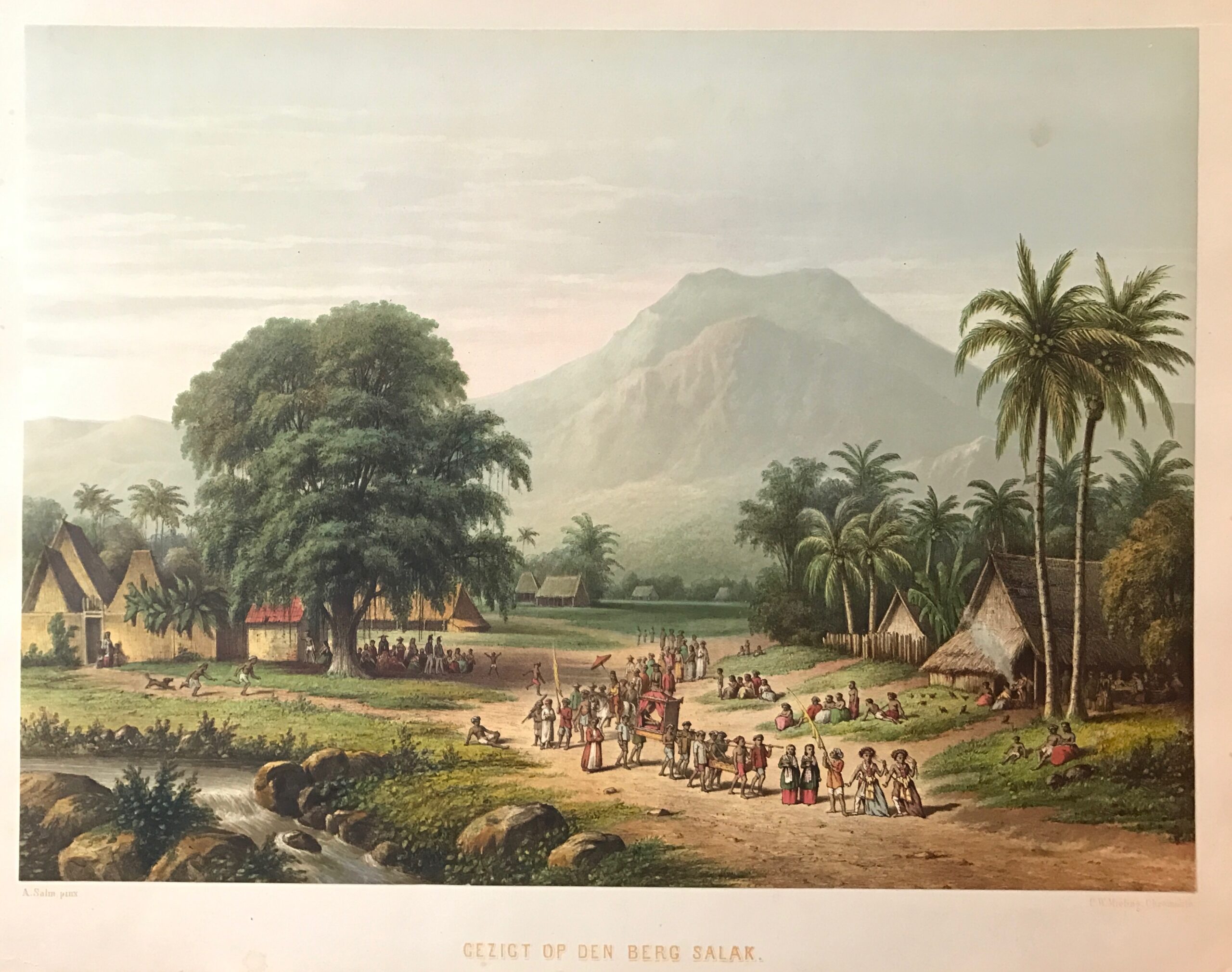
Antique Print ‘Gezicht op den Berg Salak’ by Mieling (c.1865)
Dutch East Indies
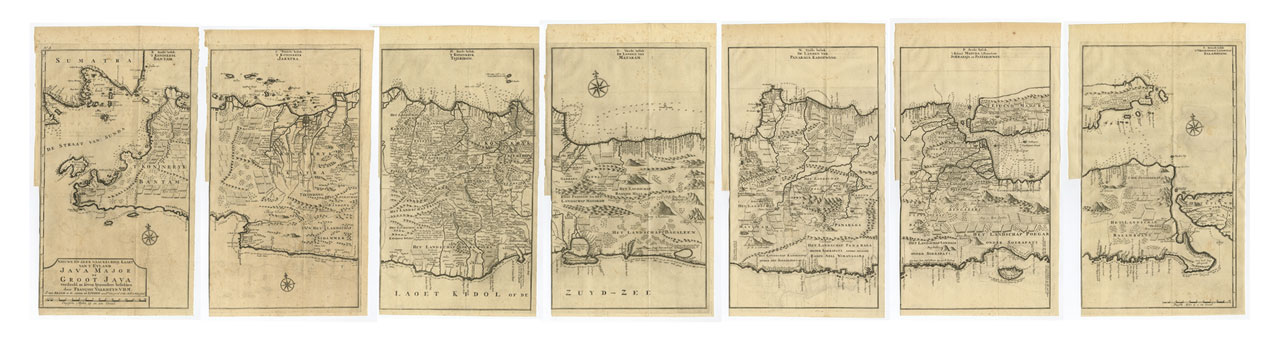
Antique Map Java in 7 Sheets by Valentijn (c.1724)
Dutch East Indies
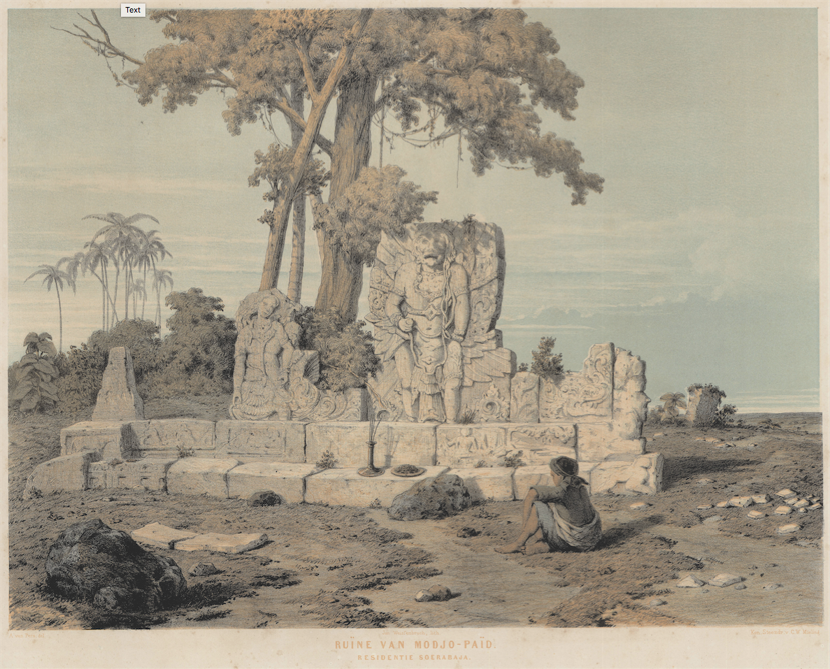
Antique Print Modjo Paid Ruins by Mieling (c.1852)
Dutch East Indies
Antique Map Java by Chatelain (1705)
Dutch East Indies
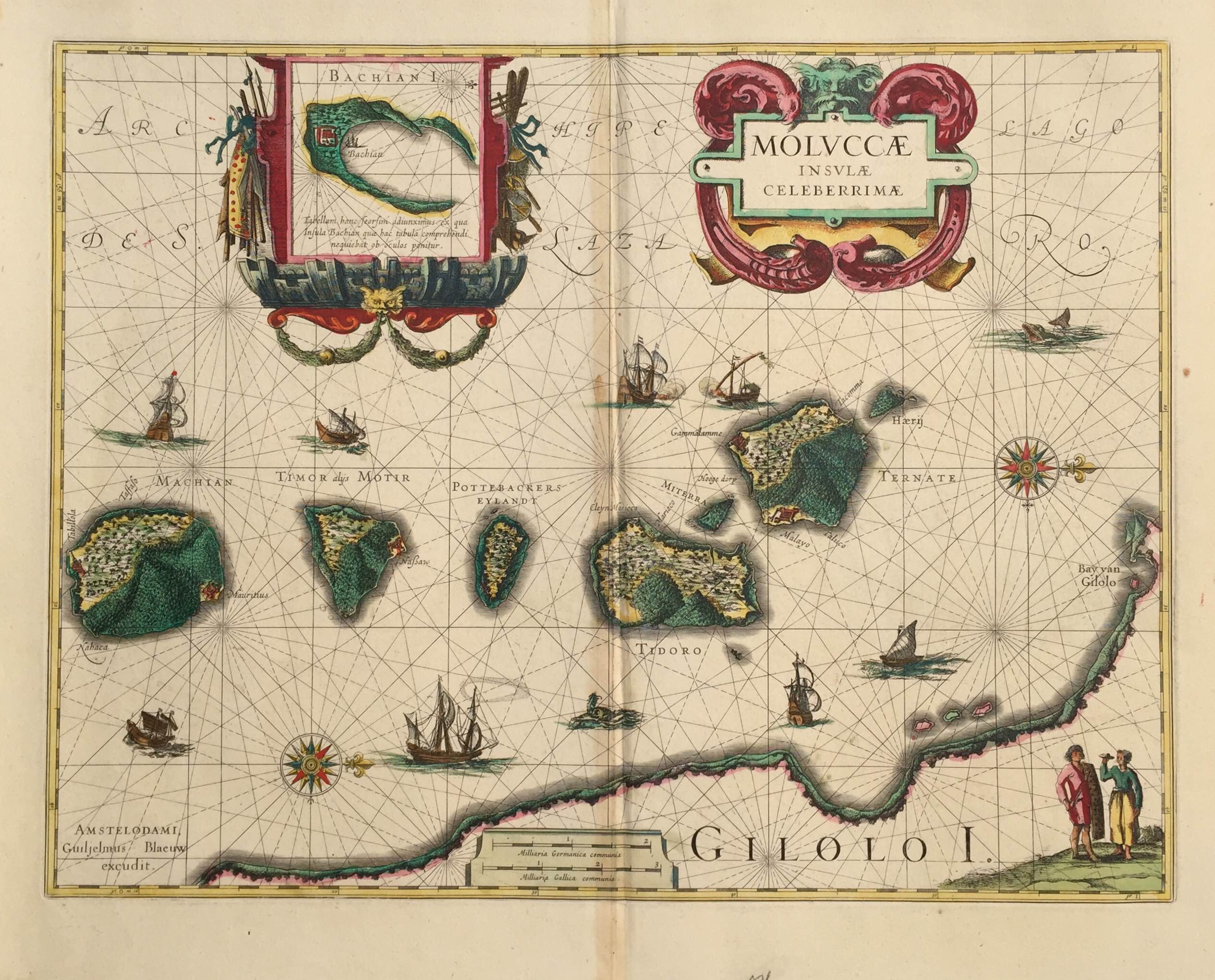
Antique Map Spice Islands by Blaeu (c.1630)
Dutch East Indies
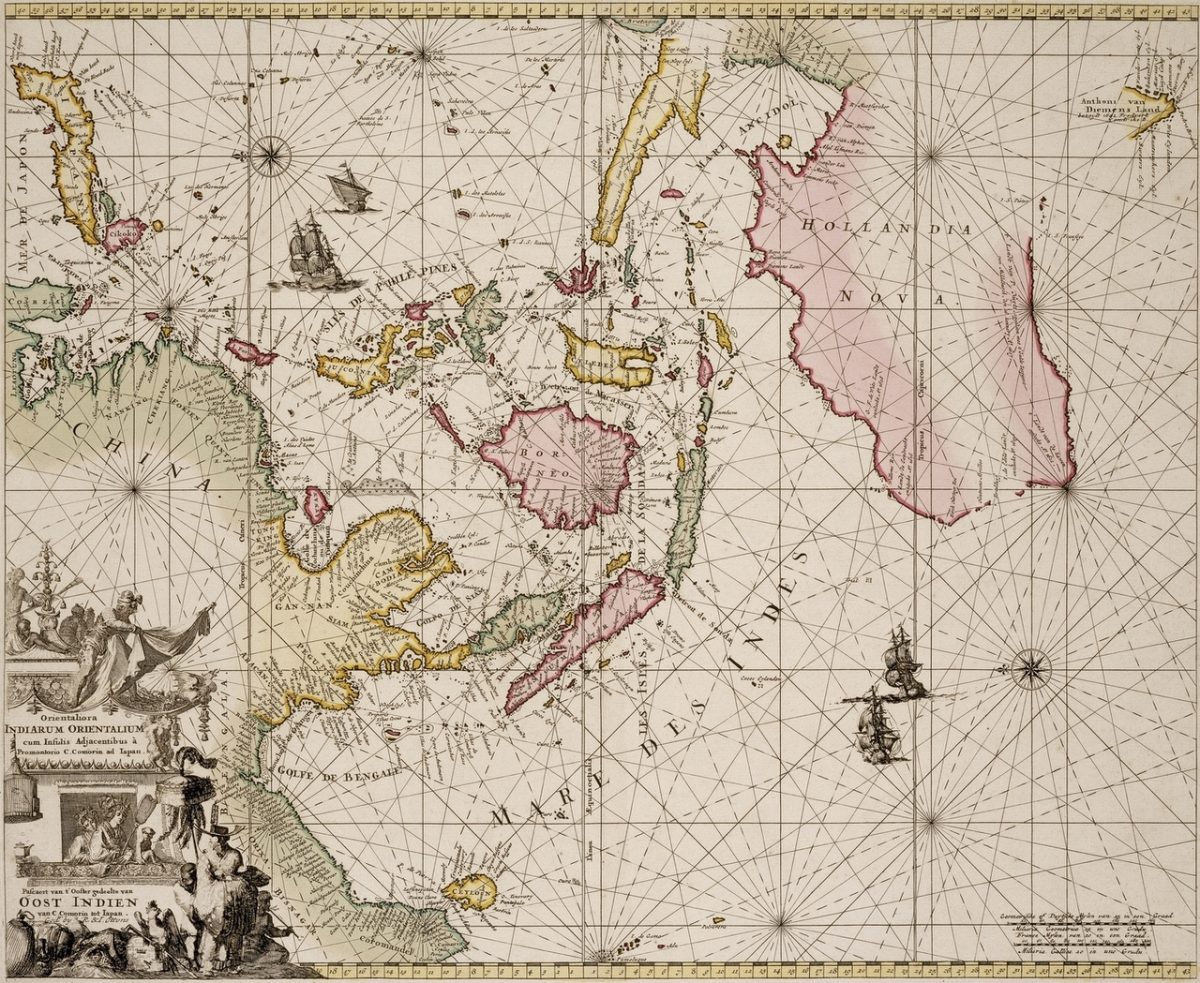
Sea Chart of East Indies and Australia – De Wit (c.1690)
Visit Gallery
WhatsApp
Shop Online
Location
Scroll to Top