Jakarta Collection
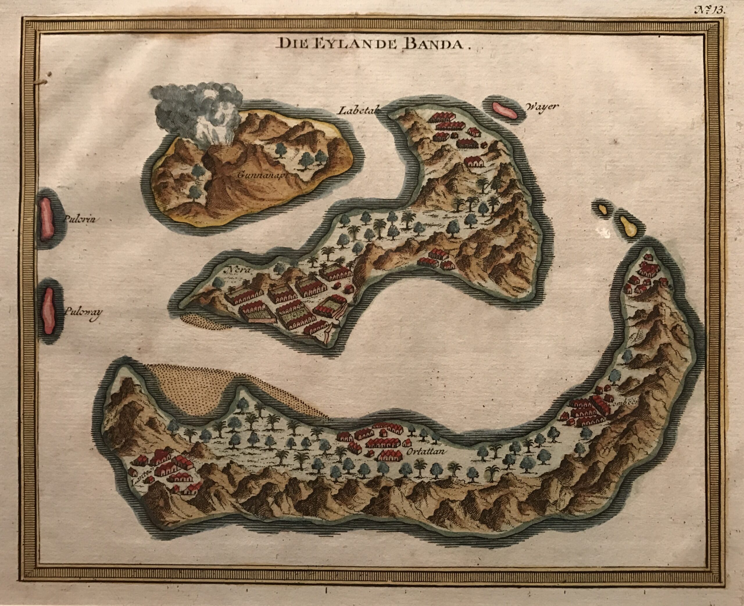
Antique Map Banda Islands by Van Schley (c.1747) – SOLD
Antique Map Banda Islands by Van Schley titled ‘Die Eylande Banda’.
Mid-18th century German map of the nutmeg and mace-producing Banda Islands in the South Moluccas, first engraved by Jacob van Schley and published in Antoine Prevost’s l’Histoire Générale des Voyages published in Paris between 1747 and 1774.
Year c.1747
Dimensions 186 x 212 mm.
Condition Very good.
Coloring Hand coloured
Technique Copperplate engraving.
Purchase Code: M1791
SOLD