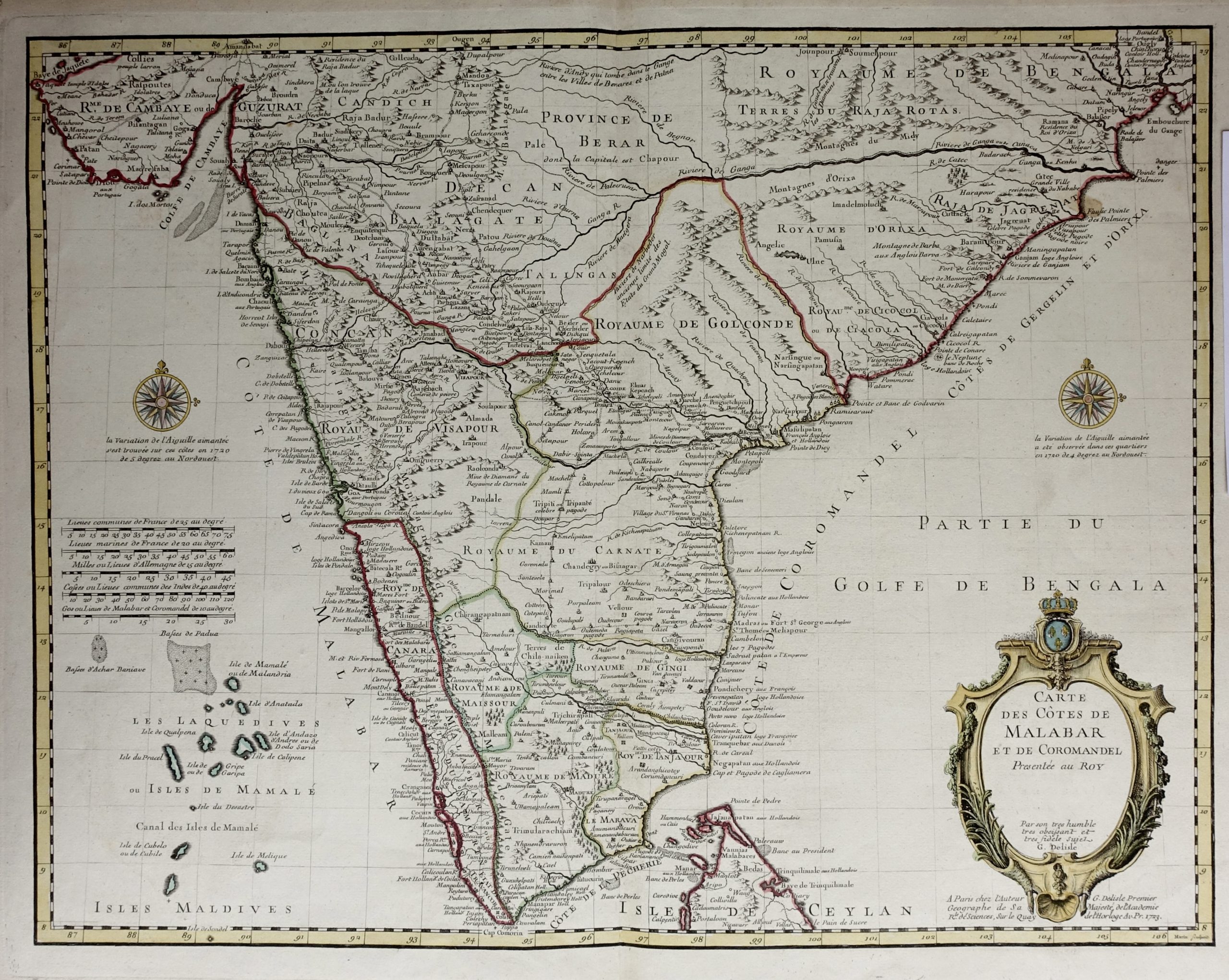
Antique Map of India and Sri Lanka – Delisle (1722)
An interesting map of India and Sri Lanka in French titled ‘CARTE DES COTES DE MALABAR ET DE COROMANDEL.’ by Guillaume Delisle.
An interesting map of India and Sri Lanka in French titled ‘CARTE DES COTES DE MALABAR ET DE COROMANDEL.’ by Guillaume Delisle.
This map extends in the northern portion of Indian to Sri Lanka and includes the Maldives in the west. Showing details of coastal towns, internal settlements, hills, and roads. The title cartouche includes decorative architecture and vegetation with the French royal coat of arms. Two compass roses flank the subcontinent. Published in 1722.
Artists and Engravers: Guillaume Delisle (or de l’Isle) 1675-1726, was a French cartographer. He studied under Jean-Dominique Cassini, and was admitted into the Académie Royale des Sciences in 1702.
Conditions: Good, age-related toning
Measurements: 680 x 500 mm
Purchase code: BG-04679