Jakarta Collection
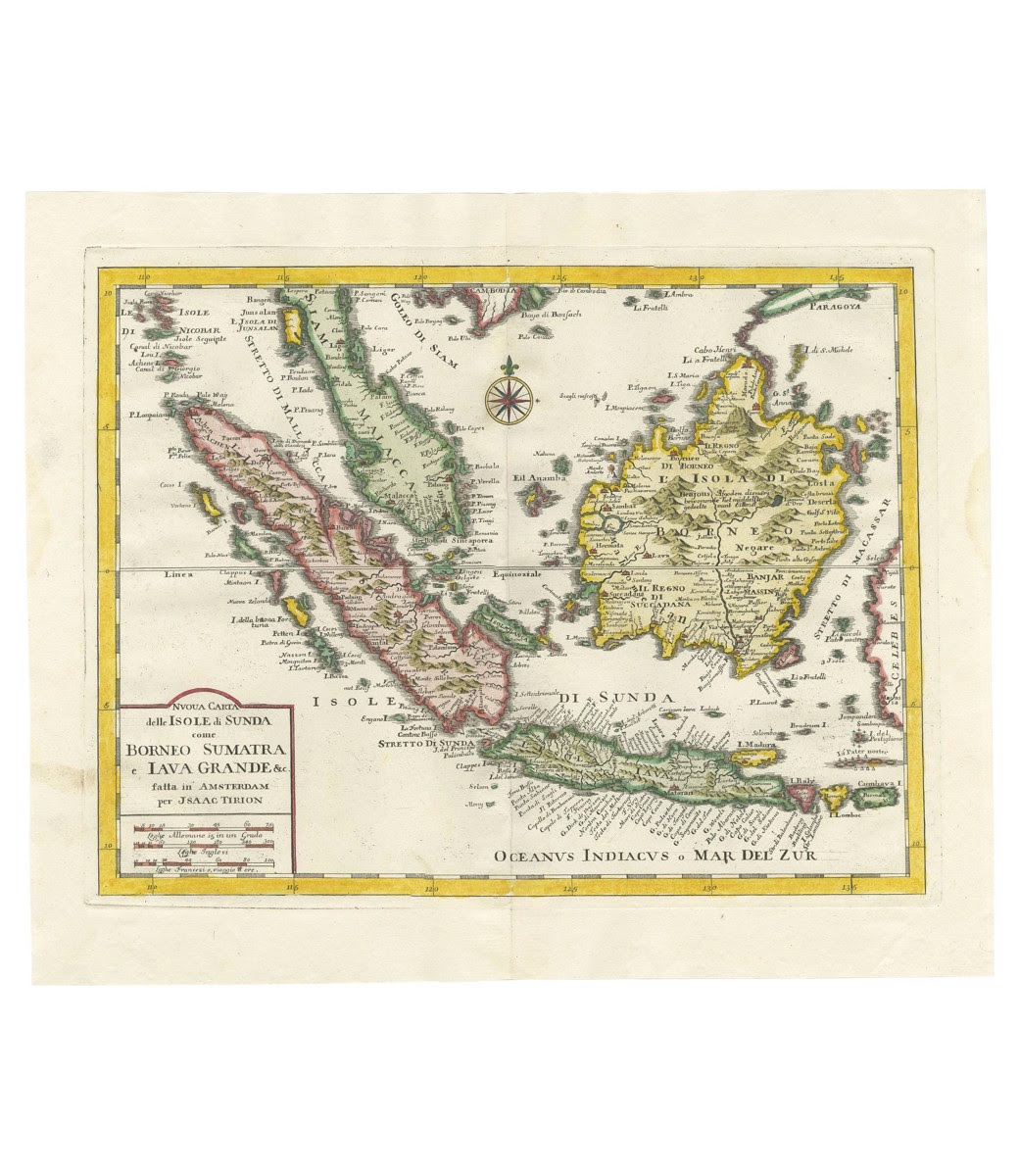
Antique Map of Sunda Islands – Tirion (c.1760)
Antique map titled ‘Nuova Carta delle Isole di Sunda come Borneo, Sumatra e Iava Grande‘.
Detailed map of the Sunda Islands, Southeast Asia, extending from the tip of Cambodia to Java. Published by I. Tirion, circa 1760.
Condition: Good General age-related toning. Original folding line. Minor wear/creasing and soiling, blank verso. Please study images carefully.
Measures : 35 x 43 x 0.05 cm
Purchase code: BG-12997