Description
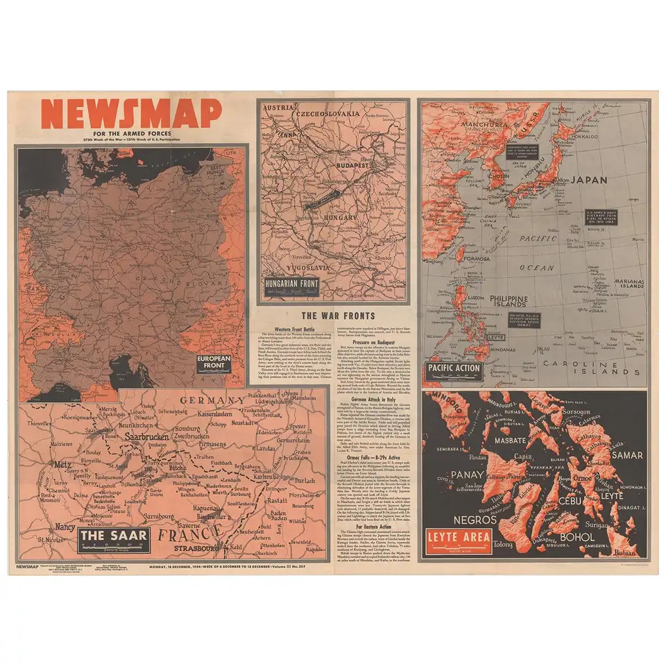
Antique map titled ‘Newsmap for the Armed Forces’. This “newsmap” was issued on Monday, December 18, 1944, and covers the news from December 6-13, 1945 – the 275th week of the war. This large sheet, measuring nearly 4 feet by 3 feet, includes five inset maps of the war situation in both Europe and Asia including the “European Front”, “The Saar”, “Hungarian Front”, “Pacific Action”, and “Leyte Area.”
The verso of this newsmap contains a large illustration of an American convoy with various vehicles and artillery identified. Text at bottom encourages preventative maintenance and states “For every spare part you don’t use – You reduce the cost of victory!” Prepared by the Army Information Branch and issued by the U.S. Government Printing Office.
From 1942-46, the U.S. Army published “newsmaps” to keep American troops updated on the war. These weekly posters were distributed and posted in every American installation in the world and were intentionally more visual than descriptive to help engage and motivate personnel.
Condtition: Issued folding on a clean sheet with a few small separations at the fold junctions.
Dimensions: 117 x 86 cm.
Purchase code : BG-12083
830,00 Euro
990,00 USD
14.300.000 IDR