Batavia Map – Schley (c.1756)
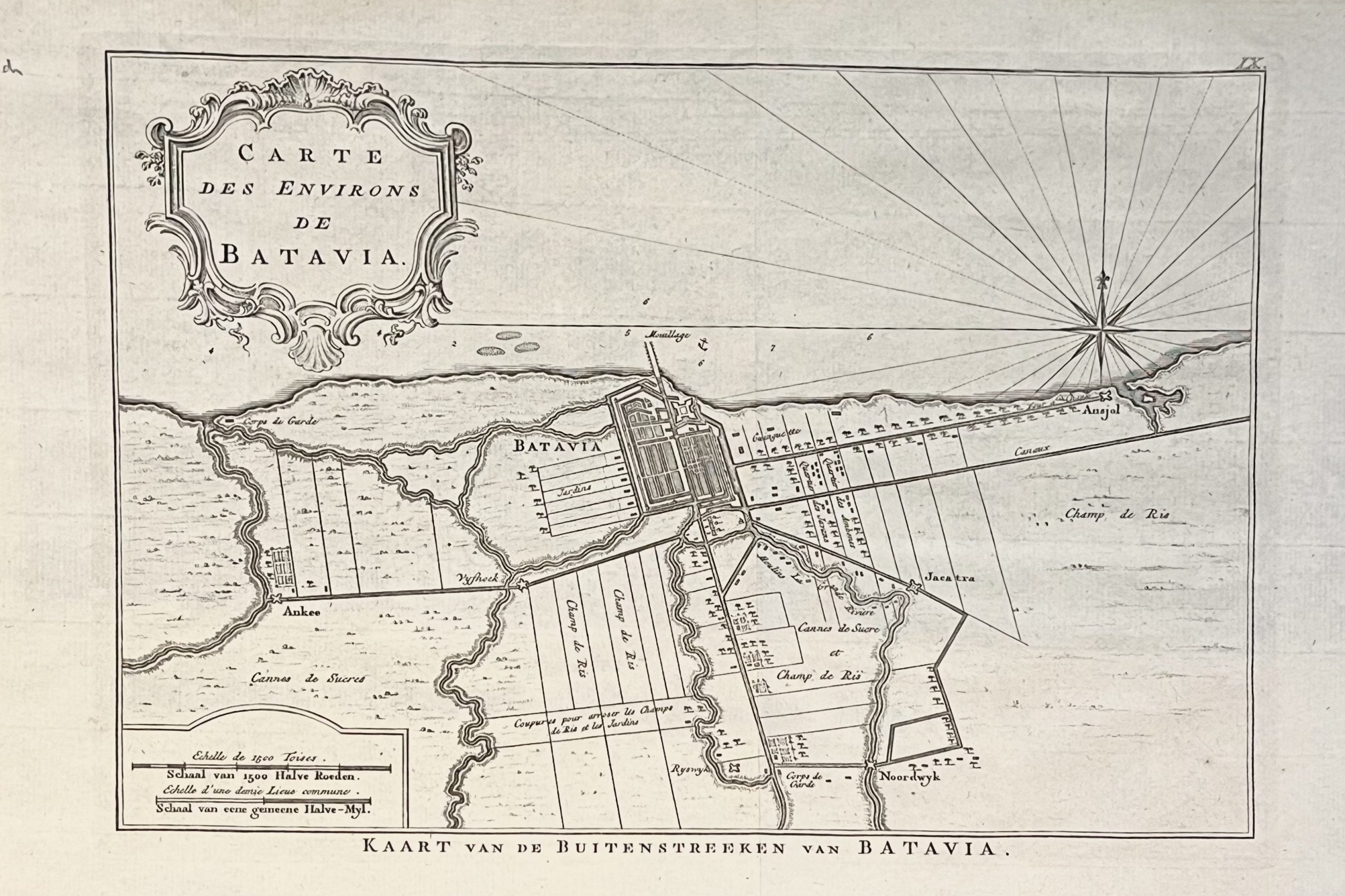
An antique mid-18th century black and white map of Batavia engraved by Jacob van der Schley (1715-1779) and published in Paris between 1747 and 1775.
‘KAART VAN DE BUITENSTREEKEN VAN BATAVIA’
An antique mid-18th century black and white map of Batavia engraved by Jacob van der Schley (1715-1779) and published in A.F Prevost’s Histoire generales de Voyages in Paris between 1747 and 1775. The map illustrates the surrounding fields, including the gardens, fortifications and housing. Several small redoubts protect the city from the interior including Ansjol, Jacatra, Noordwyk and Ankee. A large compass rose at the upper right orients the map, and a delicately engraved title cartouche completes the composition.
Condition : Very good, apart from a rough edge where removed from book
Measures : 267 x 400 mm
Purchase code M2003


