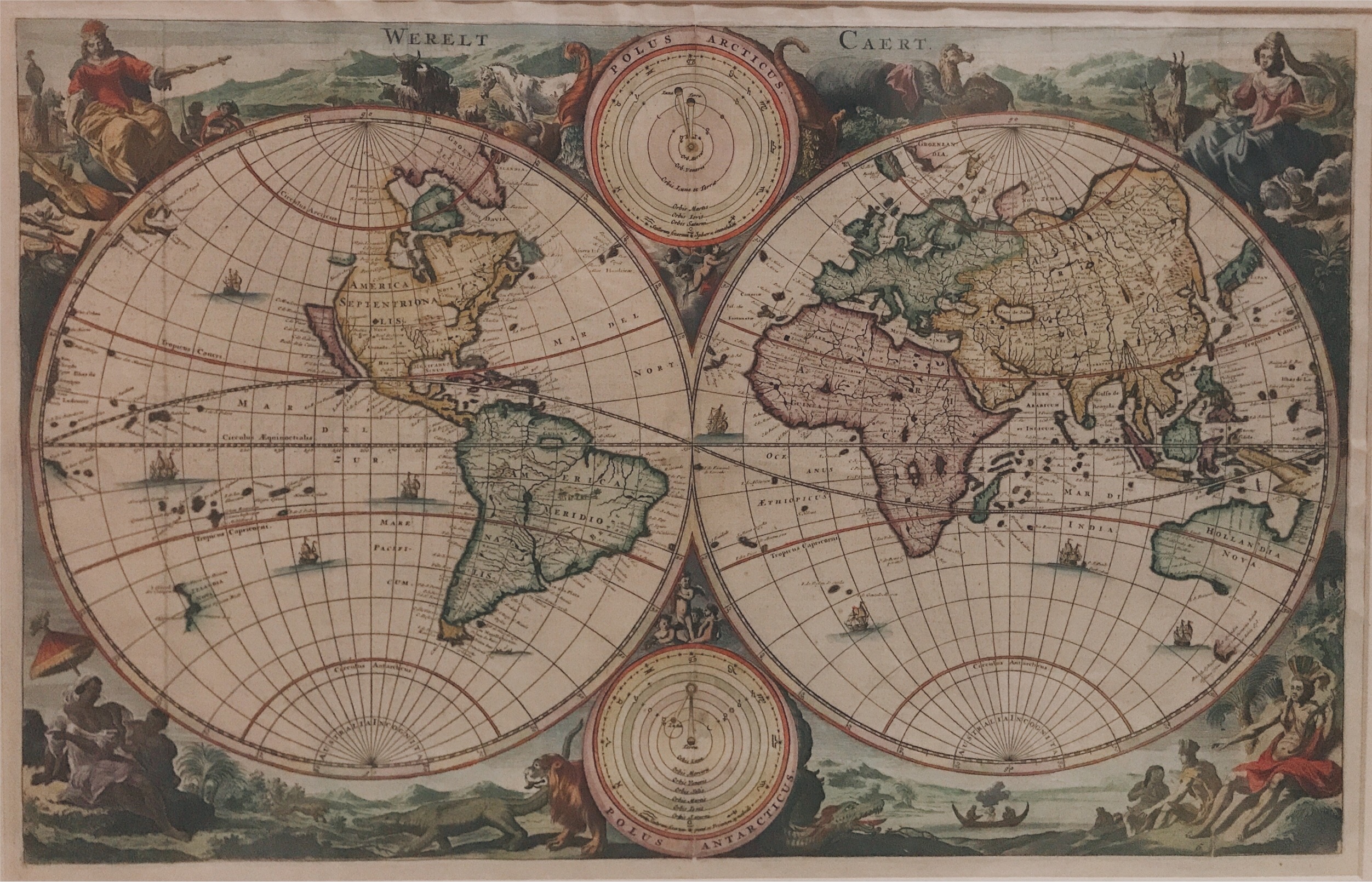
Double hemisphere world map – Stoopendaal (c.1730)
Antique maps titled’ Werelt Caert’. A fine example of the double hemisphere world map from a Dutch Bible by Dutch engraver, Daniel Stoopendaal (1672-1726).
Description: Antique maps titled’ Werelt Caert’. A fine example of the double hemisphere world map from a Dutch Bible by Dutch illustrator and engraver, Daniel Stoopendaal (1672-1726). This beautiful hand-coloured map is based on Nicholas Visscher’s map of 1663. Showing double-hemisphere world map with two solar charts, one centred around the sun, the other are earth-centered. Surround with allegorical representation of the continents. Also depicting California as an island. Dutch text on verso.
Artists and Engravers: Made by ‘Daniel Stoopendaal’ after ‘Nicholas Visscher’.
Daniel Stoopendaal (Dutch) was active in Amsterdam from 1685 to 1713.
- Date: 1730
- Technic: Engraving / etching on hand laid paper.
- Overall size: 27,4 x 20,5 inch (in frame)
- Image size: 18,7 x 11,9 inch
- Condition: Good, given age. A few minor spots. General age-related toning and/or occasional minor defects from handling.
- Purchase code: MC120


