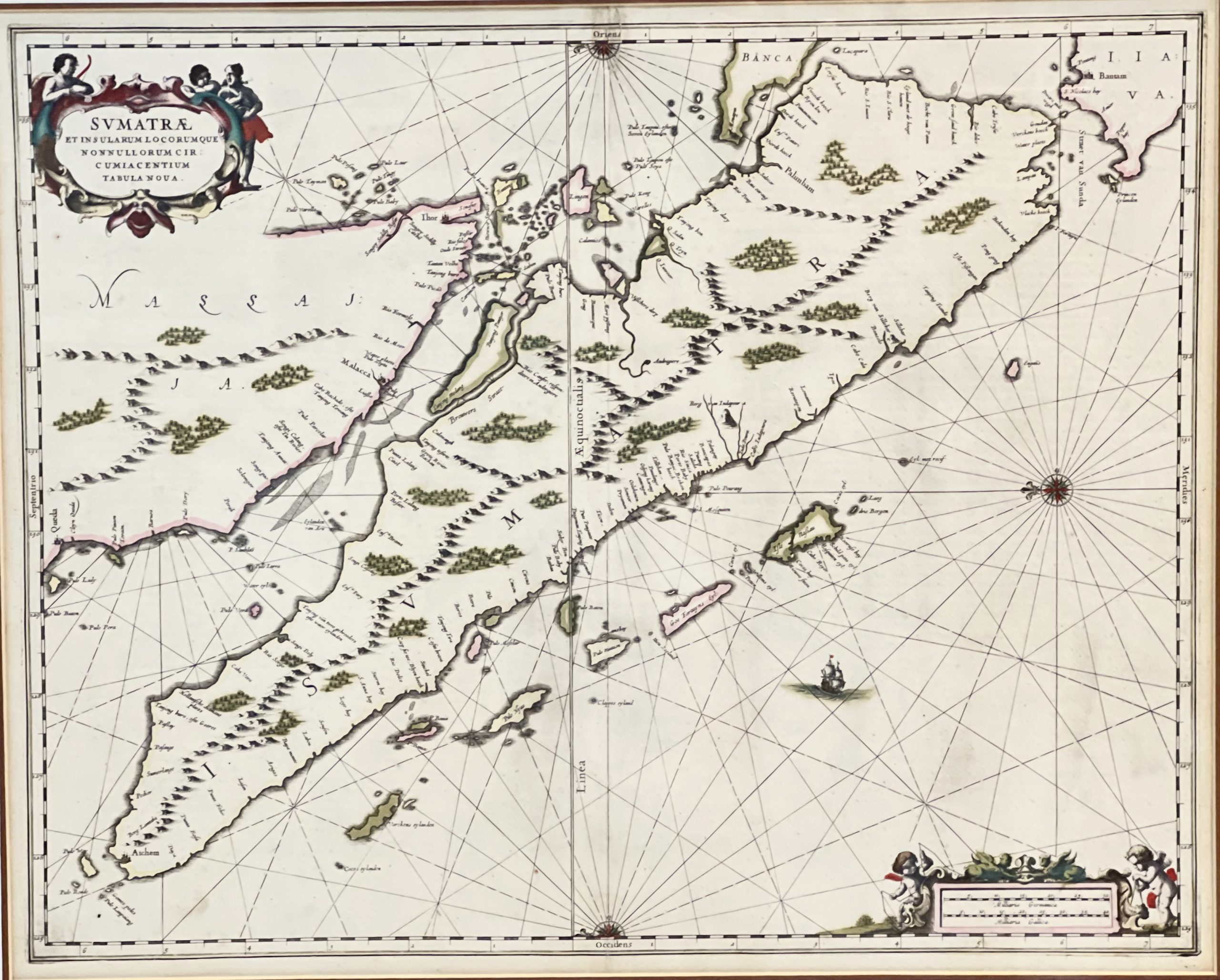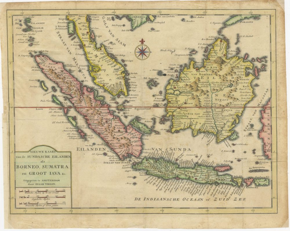
Map of Soenda Islands, Borneo, Sumatra and Java – Tirion (c.1754)
A detailed map of South East Asia mainly focused on Soenda Islands, Java, Borneo and Sumatra by Isaak Tirion, published between 1739-1754.
Attractive antique hand-coloured map titled ‘Nieuwe Kaart van de Sundasche Eiland Borneo Sumatra en Groot Java’
Detailed map of Southeast Asia, extending from the tip of Cambodia to Soenda Islands, Java. This map originates from: ‘Hedendaagsche Historie, of tegenwoordige staat van alle volkeren… II deel…’, published by Isaak Tirion, Amsterdam, 1739 ed. (originally published 1730). This is in fact an amended Dutch edition of: ‘Modern History: or the Present State of all Nations.’, published by Thomas Salmon since 1725. German, Italian and Dutch editions were published as well. This monumental Dutch edition, translated by M. van Gogh and published by Isaac Tirion, was much amended and enlarged into a 39 volume series. This plate originates from the second volume from this series which deals with: Java, Sumatra, Siam, Kochin and Tonkin.
Isaak Tirion (1705-1765), is a Dutch publisher in Amsterdam. He produced several Atlases and Dutch town plans. He moved to Amsterdam in 1725 and set up shop on Damrak as a book publisher. Tirion quick rose in prominence by publishing pamphlets, historical works, and, most importantly, maps and atlases. He eventually relocated his printing house to the prestigious Kalverstraat. In his long career he produced eight atlases in multiple editions, some of which were published posthumously until about 1784. Most of his cartographic work is based on the earlier maps of Guillaume de L’Isle.
Condition: Fair, with some brown foxing on the side
Overall size: 400 mm x 320 mm
Purchase code : BG-13270