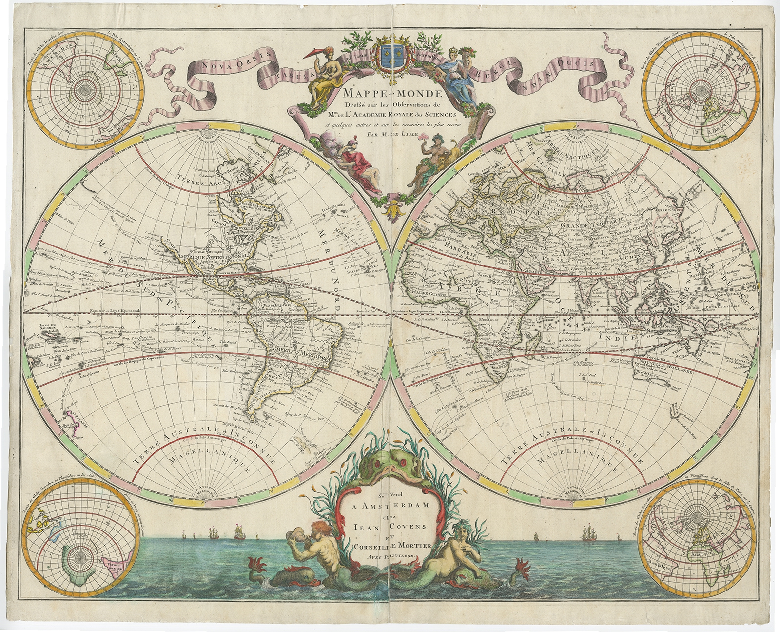
Mappe-Monde dressee sur les Observations – Covens & Mortier (c.1730) – SOLD
Description: Antique map titled ‘Mappe-Monde Dresse sur les Observations de Mrs de l’Academie Royale des Sciences et quelques autres et surles memoirs les plus recens Par M. De L’Isle ‘. First edition of Covens & Mortiers’s Decorative double hemisphere map of the World, being the first edition to illustrate the routes of a number of the most famous explorers of the major oceans of the World from 1542 to approximately 1730, pre-dating the inclusion information from the Russian voyages of Tchirikow and Bering, which would begin to appear in 1745.Ornate double hemisphere with four polar projections around the edge, viewing the earth from varying angles. Some of the more noteworthy features of the map include the lack of a Northwest Coat of America and remanant of the old Northeast Asian coatline running toward North America. Other features include Edmund Halley’s sighting of Antarctic ice; Bouvet’s large Cap de la Circoncision; A depiction of the tracks of Pelsart’s route from Australia to Java; Carpentaria attached to New Guinea; Tasman’s route, along with a depiction of Tasmania as per Tasman, distinctly separate from Australia. The map also retains one of the more curious peninsular depictions of California.
Artists and Engravers: Cartographer: J.N. de l’Isle. Publishers: Covens & Mortier.
- Date: c.1730
- Overall size: 65.5 x 53.5 cm.
- Image size: 64 x 49.5 cm.
- Condition: Good. General age-related toning. Later hand colouring. Repairs on centerfold and marginal tears. Please study image carefully.
- Purchase code: BG-07891
SOLD