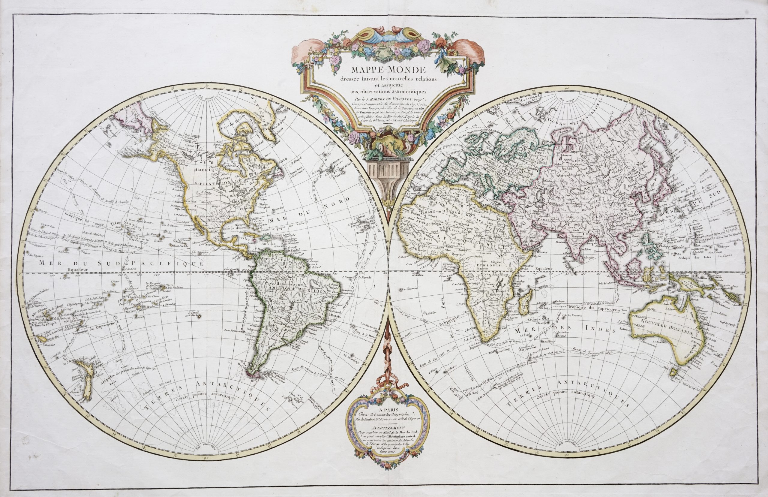
Mappe Monde (World Map) – Vaugondy c.1812
A very fine early 19th century French twin hemisphere map of the world in old colour originally compiled by Didier Robert de Vaugondy (1723-1786).
Titled ‘Mappe-Monde dressee suivant les nouvelles relations et assujettie aux observations astronomiques . . . par le S.ROBERT DE VAUGONDY, Geog’
A very fine early 19th century French twin hemisphere map of the world in old colour originally compiled by Didier Robert de Vaugondy (1723-1786) and updated to show the voyages of Cook, Vancouver, Mackensie and Perouse by Charles Francois Delamarche (1740-1817), a geographer, globe-maker and publisher of Rue de Jardinet No.13 vis a vis celle de l’Eperon between 1805 and 1807.
The map without the voyages of the late 18th and early 19th century explorers was probably published in Vaugondy’s Nouvel Atlas adn Nouvel Atla Portatif between 1785 and 1800. This particular map was published by Delamarche c.1812
Good condition, apart from age-toning and folding marks
Measures 468 x 737 mm
Purchase code M0941