Jakarta Collection
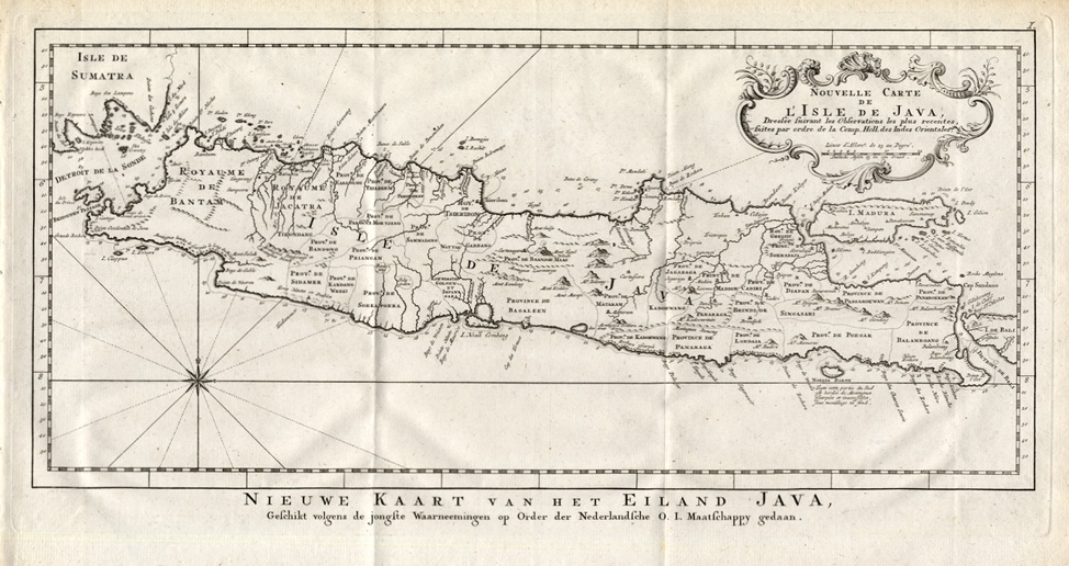
Nouvelle Carte de l’ Isle de Java – Conradi (1782)
Description: Antique Map ‘Nouvelle Carte de l’ Isle de Java.’ (New Map of Java.) This very detailed map shows the Indonesian Island of Java. With cartouche, scale and compass rose.
This print is taken from ‘Batavia, de Hoofdstad van Neerlands O. Indien…’, published by Petrus Conrade and Volkert van der Plaats, 1782.
Artists and Engravers: Unknown.
- Date: 1782
- Technic: Copperplate engraving on verge type hand laid paper with watermark. Original folds.
- Overall size: 18,9 x 10,6 inch
- Image size: 17,3 x 8,5 inch
- Condition: Excellent; general age related toning; some light staining from handling.
- PartNumber: PCT-14564
- Storage Location: (BG) A165-10