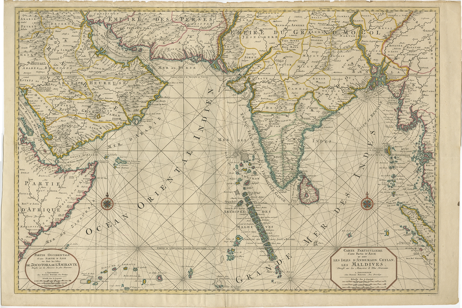
Partie Occidentale d’une partie d’Asie (..) – Mortier (c.1700)
Description: Two-sheet map of Asia, joined. The left part of this antique map is titled ‘Partie occidentale d’une partie d’Asie ou sont les Isles de Zocotora, de l’Amirante’. The right part of this antique map is titled ‘Carte Particuliere d’une Partie d’Asie ou sont Les Isles D’Andemaon, Ceylan, Les Maldives’. This map depicts the Maldives, the Andaman Islands, and Ceylon (Sri Lanka). Sumatra peeks out of the eastern border, with the southwest peninsula showing the Kingdoms of Siam, Mataban, Pegu, and, to the north, Grant Thibet. Beautiful antique map of the Indian Ocean, extending from Saudi Arabia and the Horn of Africa in the west to the Straits of Malacca, with the focus centered on India and Pakistan. This antique map originates from ‘Neptune Francois’.
Artists and Engravers: Pierre, or Pieter, Mortier (1661-1711) was a Dutch engraver, son of a French refugee.
- Date: c.1700
- Overall size: 94 x 63 cm.
- Image size: 87 x 59 cm.
- Condition: Very good, minor defects from handling. Original, contemporary hand coloring. Please study image carefully.