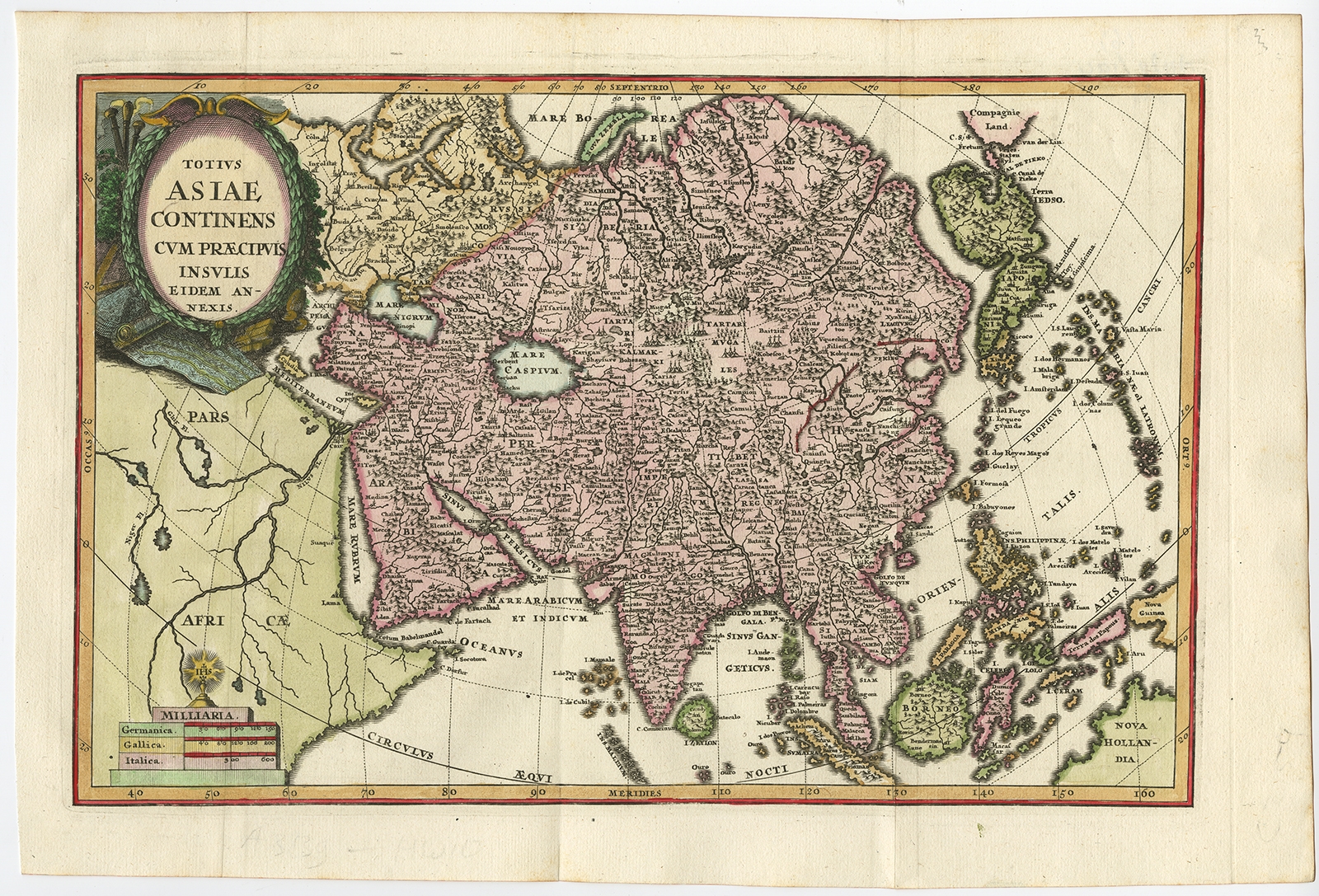
Totius Asiae Continens (..) – Scherer (1702)
Description: Antique print, titled: ‘Totius Asiae Continens (…).’ – On this map of continental Asia and the adjacent islands Japan is shown with an oversized Terra Iedso (Hokkaido) connected with Honshu via a narrow isthmus. The Compagnie Land of the de Vries expedition is shown above, separated by a narrow strait named after the explorer. Nova Zembla is depicted correctly as an island, but the northeastern part of Siberia, the Chukchi peninsula and Kamchatka are missing. A portion of Australia is shown as Nova Hollandia with New Guinea shown separate from Terra des Papous. The title is surrounded with a beautifully engraved cartouche, and the scale of miles is topped by the symbol for the Society of Jesus.
Source unknown, to be determined.
Artists and Engravers: Made by ‘Heinrich Scherer’ after an anonymous artist. Heinrich Scherer (1628-1704) was a Professor of Hebrew, Mathematics and Ethics at the University of Dillingen until about 1680. Thereafter he obtained important positions as Official Tutor to the Royal Princes of Mantua and Bavaria. It was during his time in Munich as Tutor to the Princely house of Bavaria that his lifetime’s work as a cartographer received acclaim and recognition. Scherer’s world atlas, the Atlas Novus, first published in Munich between 1702 and 1710 and reissued in a second edition between 1730 and 1737, forms a singularly unusual, almost revolutionary work in terms of the development of European mapmaking at the beginning of the 18th Century.
- Date: 1702
- Technic: Engraving / etching with hand colouring on hand laid (verge) paper.
- Overall size: 15,9 x 10,7 inch
- Image size: 13,9 x 9,1 inch
- Condition: Very good, given age. Original folds as issued. General age-related toning and/or occasional minor defects from handling. Please study scan carefully.
- PartNumber: PCT-59204
- Storage Location: BG-Iscra-B12-41
- Price : 542,5 Euro / 647,5 USD / 9.300.000 IDR