Description
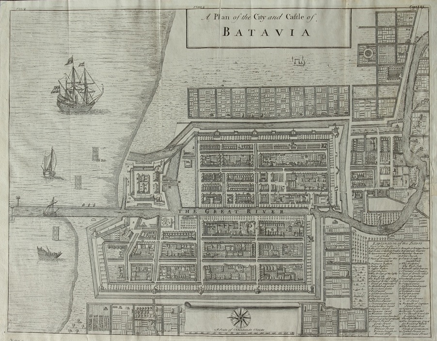
Antique Map Batavia by Bowen titled ‘A Plan of the City and Castle of BATAVIA’.
An attractive black and white mid-18th century plan of Batavia probably by the great English cartographer Emanuel Bowen (1693/94 – 1767) and possibly published in London on A Complete System of Geography between 1744-47. The plan is a smaller copy of the earlier mid-17th century folio plans of Batavia produced by the Dutch cartographers Clement de Jonghe and Frederick de Wit.
Artist: E. Bowen
Year: c.1744
Condition: Very good
Measurements: 318 x 417 mm.
Purchase Code: M1696
SOLD