Description
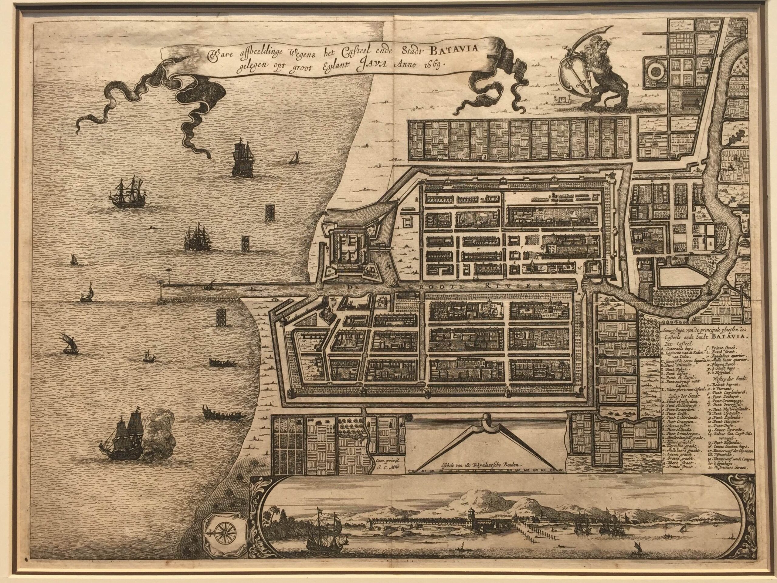
Antique Map Batavia by Van Meurs titled ‘Ware affbeeldinge wegens het Casteel ende Stadt BATAVIA/gelengen opt groot eylant JAVA Anno 1669′.
A very fine and mid- to late 17th century black and white plan of Batavia published by Jacob van Meurs (1619/20 – 1680), map publisher, engraver and bookseller of Arnhem, later Amsterdam in Gedenkwaerdige gesantschappen der Oost-Indische maatschappy in in ‘t Vereenigde Nederland by Arnoldus Montanus (c. 1625 – 1683) in 1669, a Dutch missionary, explorer and theologian. The map has a vignette at the bottom showing Jakarta from the sea with the volcanoes Mount Gede, Mount Pangrnago and Mount Salak in the background. The plan is based on the earlier, much larger map of Batavia published by Clement de Jonghe in 1650.
Very good condition; measures 266 x 355 mm.
Purchase code: M1821
20.000.000 IDR
1.200 Euro
1.400 USD

