Subtotal: $8.850,00
- Selection Required: Select product options above before making new offer.
- Error: There was an error sending your offer, please try again. If this problem persists, please contact us.
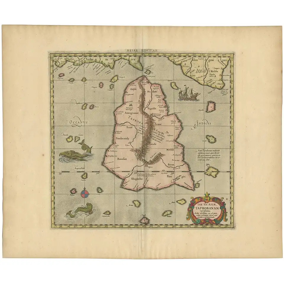
Antique Map of Sri Lanka by Ptolemy/Mercator, circa 1695
$765,00
Description
Antique map titled ‘Tab XII Asiae Taprobanam’. Ptolemaic map of Taprobana (Sri Lanka). Ptolemy drew on the accounts of travelers and sailors and though the information was secondhand and often inaccurate it represented the most advanced account of the world’s geography at that time. This map depicts the island with the typical misconceptions of Ptolemy with the island straddling the Equator and nearly divided by a ridge of mountains. A small part of India is incorrectly shown in the northeast corner of the map. The stipple engraved sea is filled with an oriental ship and two great sea monsters. Embellished with a strapwork title cartouche.
Conditions: General age-related toning, blank verso. Please study images carefully.
Dimensions: 53.5 x 45 cm.
Purchase code : BG-12283
645,00 Euro
770,00 USD
11.200.000 IDR
Related products
-
 $150,00
 -
$3.600,00
-
$0,00
-
$800,00