Description
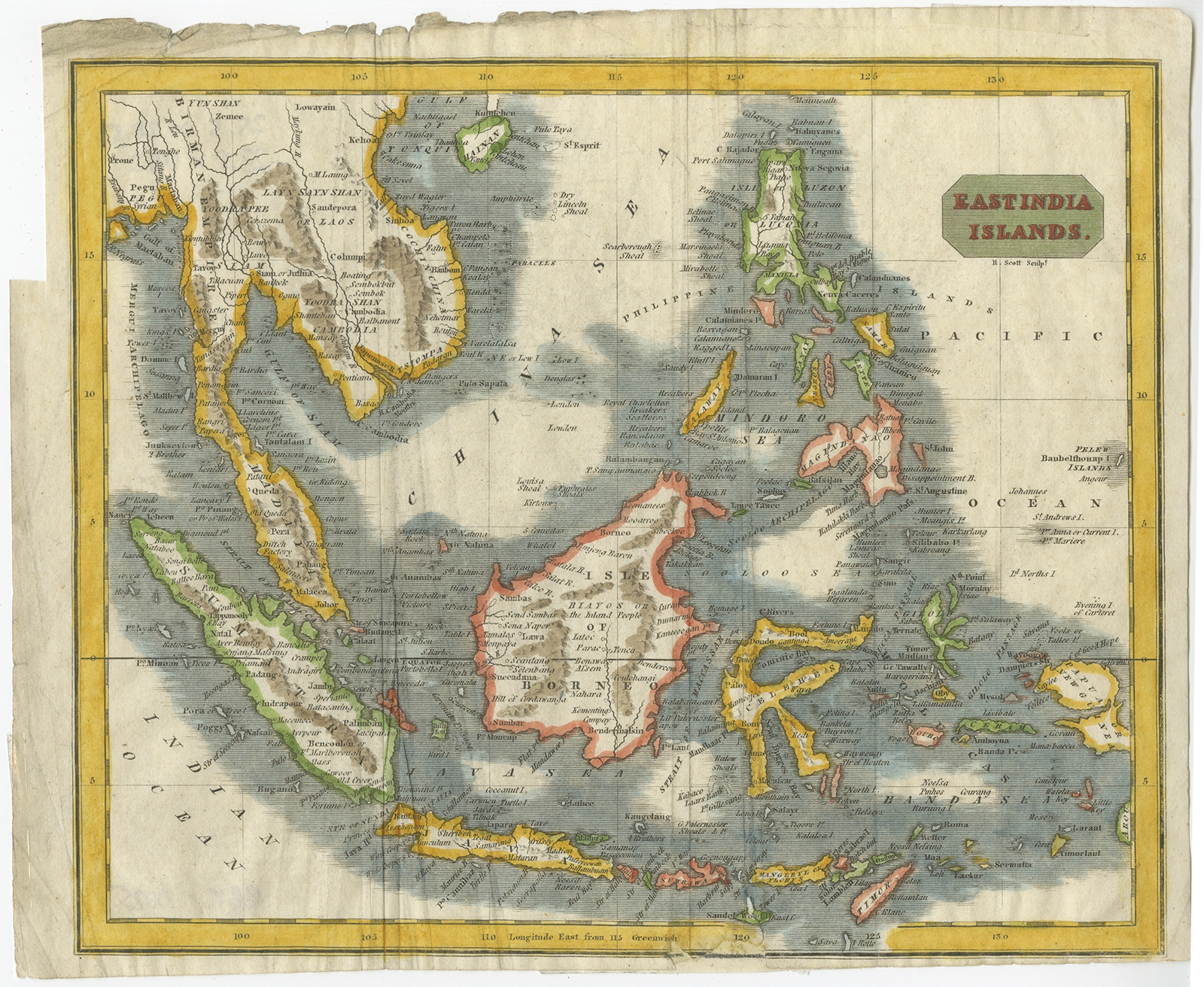
Description: Antique map titled ‘East India Islands’. Scarce and highly detailed map of Southeast Asia and the Philippines. The map extends from Hainan and the Gulf of Tonkin to Pegu and the Bay of Bengal, in the North and showing all of the Philippines, Papual New Guinea, Timor, Java, Sumatra and the Malaysian Peninsula.
Artists and Engravers: Engraved by R. Scott.
- Date: c.1810
- Overall size: 25.5 x 20.5 cm.
- Image size: 23.5 x 19.5 cm.
- Condition: Fair, some defects and creasing. Repair lower margin. Please study image carefully.
- Purchase code: BGJC-0025
- SOLD.