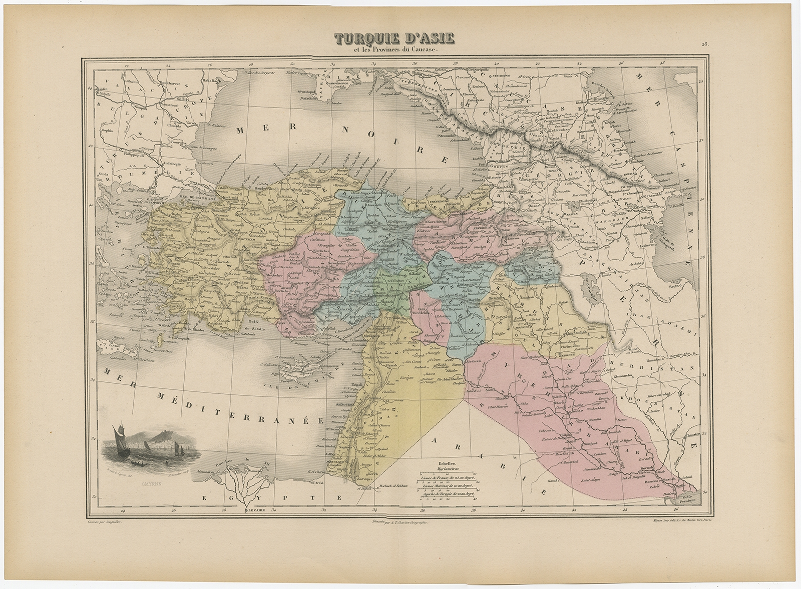
Antique Map of Turkey in Asia by Migeon (1880)
Description: Antique map titled ‘Turquie d’Asie et les Provinces du Caucase’. This map covers from the Crimea south to Egypt, west as far as the Aegean, and east to the Caspian Sea and the Persian Gulf. The map essentially covers the mid-19th century claims of the Ottoman empire, including the modern nations of Turkey, Iraq, Kuwait, Syria, Jordan, Israel or Palestine, Armenia, Georgia, and Azerbaijan, with parts of adjacent Iran, Greece, egypt and Ukraine. The lower left quadrant includes a beautiful illustration of Smyrne (the ancient city of Smyrna). The map dates to the last days of the Ottoman empire, whose influence, though rapidly declining, dominated much of the Middle east. Various rivers, islands, mountain passes and other topographical features are identified. This map originates from ‘Géographie Universelle Atlas-Migeon’ by J. Migeon.
Artists and Engravers: Published by J. Migeon. Reviewed by A. Vuillemin. Alexandre Vuillemin (1812-1880) was a cartographer and an book editor based in Paris, France.
- Date: 1880
- Overall size: 47.5 x 34.5 cm.
- Image size: 37.5 x 27.5 cm.
- Condition: Good, age-related toning. Please study image carefully.
- Purchase code: BG-11793-30