Subtotal: $850,00
- Selection Required: Select product options above before making new offer.
- Error: There was an error sending your offer, please try again. If this problem persists, please contact us.

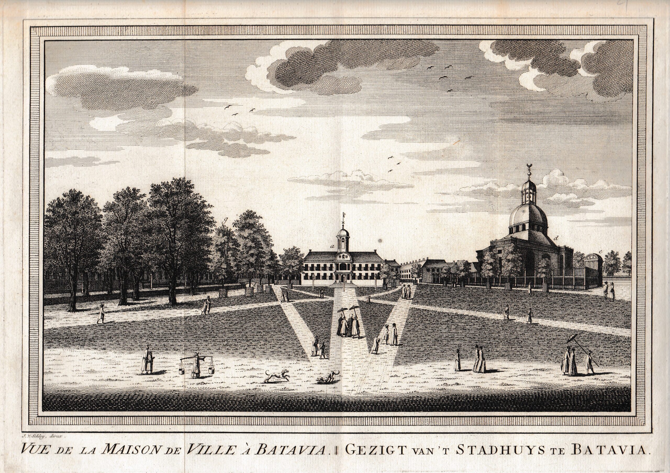
Carte de L’Isle Celebes ou Macassar – Bellin (c.1750)
$150,00
Description
Description: Antique map, titled: ‘Carte de L’Isle Celebes ou Macassar.’ – Nice small map of the present-day island of Sulawesi in Indonesia. Locates many villages and regions with details of rivers and mountain ranges.
Source unknown, to be determined.
Artists and Engravers: Made by ‘Jacques-Nicolas Bellin’ after an anonymous artist. Jacques-Nicolas Bellin (1703-1772) was a French hydrographer, geographer and member of The Philosophes. His career, spanning over 50 years, caused an enormous outut in maps, particular of maritime interest. He was appointed the first Ingenieur Hydrographe de la Marine, and also Official Hydrographer to the French King. In smaller format, he issued the Petit Atlas Maritime (1764), which contained 580 charts, as well as maps to illustrate l’ Abbe Prevost’s Histoire Generale des Voyages (1746-1757). Bellin also produced a substantial number of important separately issued maps.
- Date: 1750
- Technic: Engraving / etching with hand colouring on hand laid (verge) paper.
- Overall size: 7,5 x 9,6 inch
- Image size: 5,8 x 8,1 inch
- Condition: Good, given age. One minor spot, hardly visible. General age-related toning and/or occasional minor defects from handling. Please study scan carefully.
- PartNumber: PCT-61401
- Storage Location: BG-B15-40 Iscra
- Price: 124,5 Euro / 146 USD / 2.120.000 IDR
Related products
-
 $1.300,00
 -
-
-
$1.520,00