Jakarta Collection
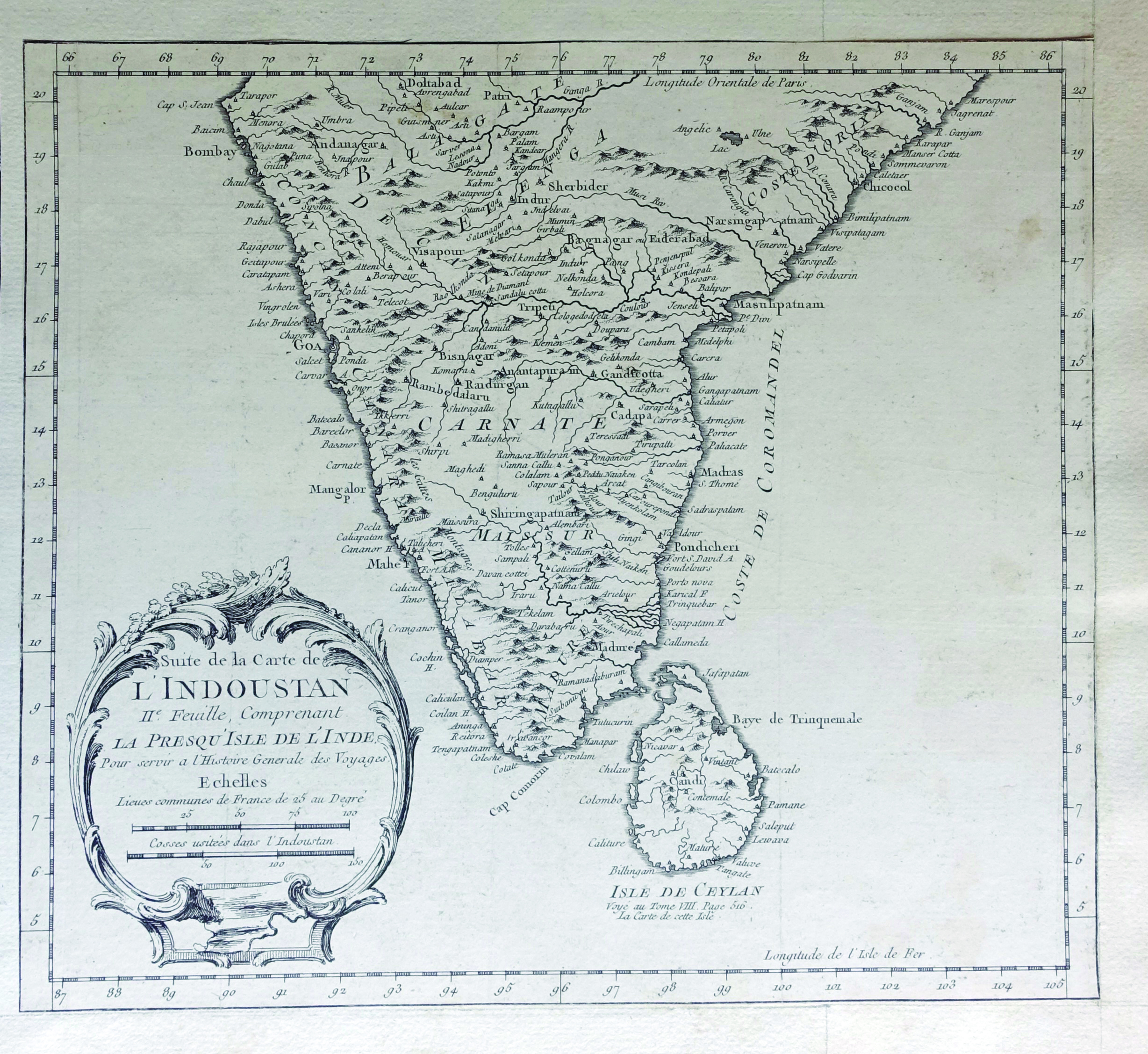
Hindoostan or Map of India and Sri Lanka – Bellin (1752)
A rare black and white French map of Hindoostan or India with Ceylon or Sri Lanka, by Jakob van der Schley & Jacques Nicolas Bellin between 1752-1755.
A rare black and white French map of Hindoostan or India, titled ‘Suite de la Carte de l’Indoustan, IIe Feuille, comprenant la Presqu’isle de l’lnde’ by Jakob van der Schley & Jacques Nicolas Bellin in between 1752-1755. This map is centered in the southern part of Indian subcontinent, including Ceylon or Sri Lanka.
- Measurements : 283 x 270 mm
- Condition: Very good; general age related toning; some light brown staining from handling.
- Purchase code: BGJC-00105


