Description
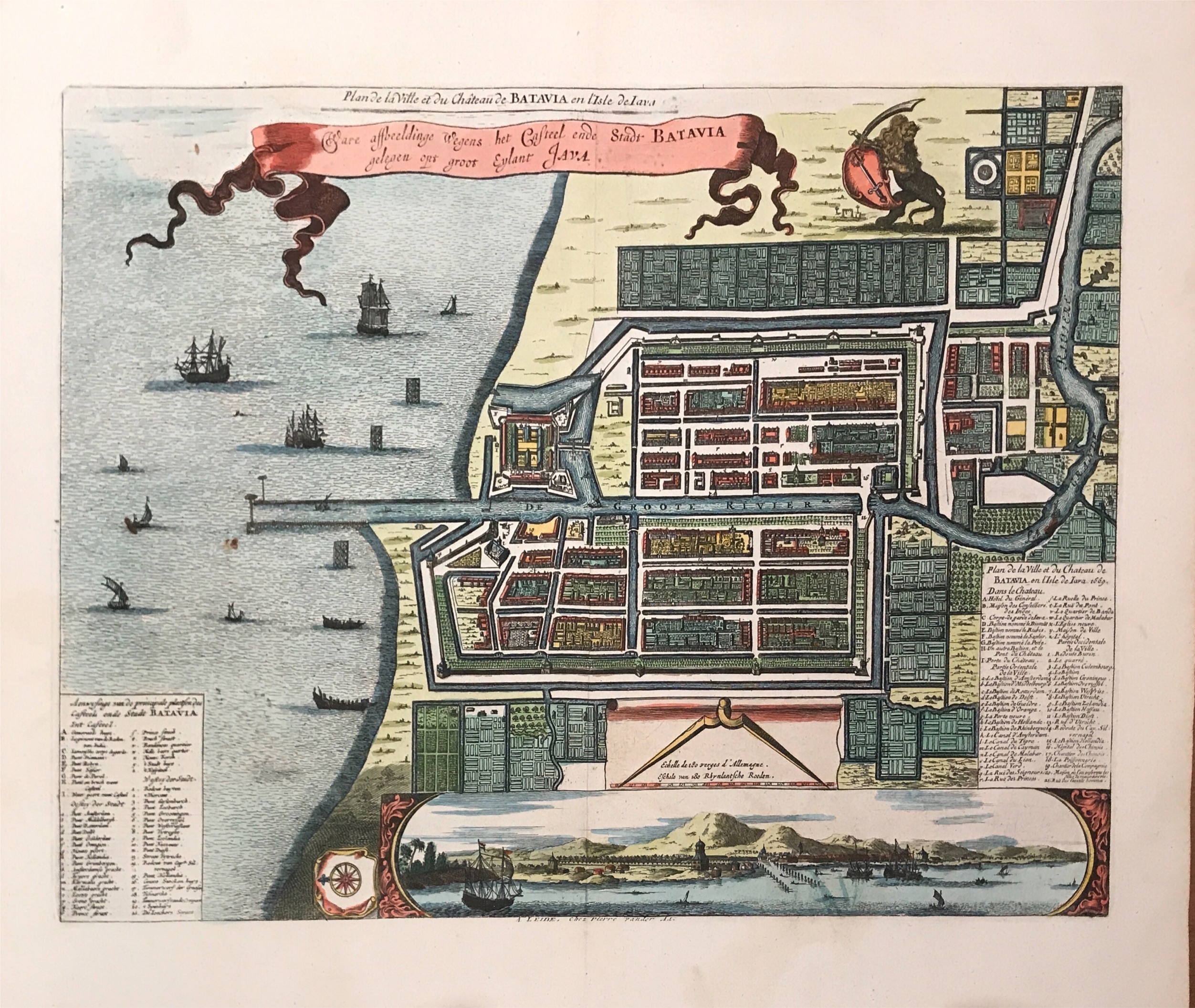
Antique Map Batavia in original hand-colour by Van Meurs titled ‘Ware affbeeldinge wegens het Casteel ende Stadt BATAVIA/gelengen opt groot eylant JAVA Anno 1669′.
A very fine and very rare late 17th to early 18th century plan of Batavia in good modern colour that has a vignette at the bottom showing Jakarta from the sea with the volcanoes of Mount Gede, Mount Pangrango ann Mount Salak in the background. The plan is based on the earlier, much larger map of Batavia published by Clement de Jonghe in 1650. This particular map is identical in most respects to the plan of Batavia published by Jacob van Meurs (1619-1680) a map publisher, engraver and bookseller of Arnhem, later Amsterdam.
Conditions: Very good
Measurements: 400 x 360 mm
Purchase code: BG-11791