Subtotal: $605,00
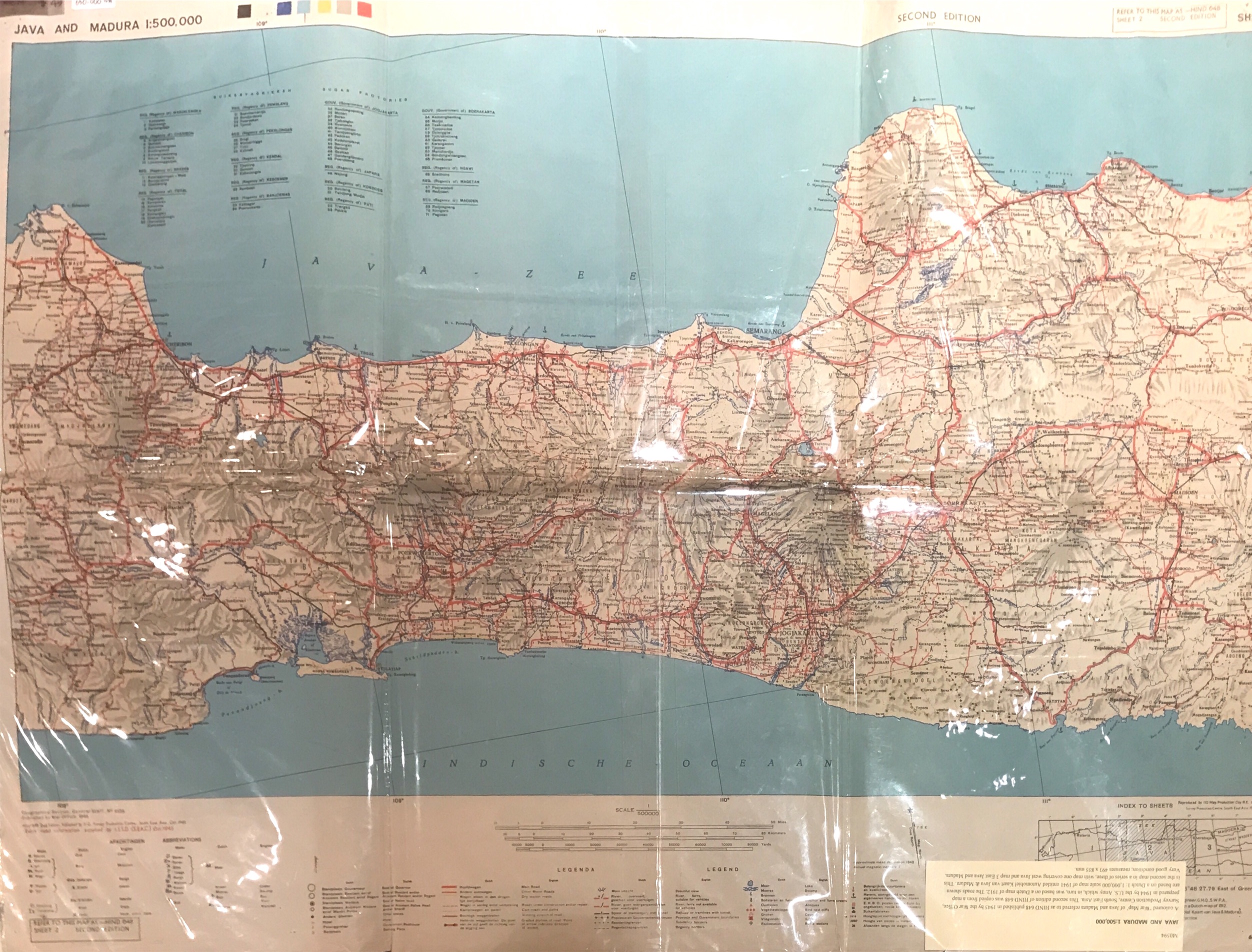
Map of Java and Madura – War Office (1945)
$0,00
A coloured ‘War Map’ of Java and Madura referred to as ‘HIND 648’ published in 1945 by the War Office, Survey Production Centre, South East Asia.
Out of stock
Description
A coloured ‘War Map’ of Java and Madura referred to as ‘HIND 648’ published in 1945 by the War Office, Survey Production Centre, South East Asia. This second edition of HIND 648 was copied from a map prepared in 1944 by the U.S Army which, in turn, was based on a Dutch map of 1912. The roads shown are based on a Dutch 1 : 1,000,000 scale map of 1941 entitles Automobiel Kaart van Java & Madura. This is the second map in a series of three, with map one covering West Java and map 3 East Java and Madura.
Very good condition
Measures 493 x 855 mm
Purchase c0de M0594
SOLD
Related products
-

-
$0,00
-
$0,00
-
$830,00