Description
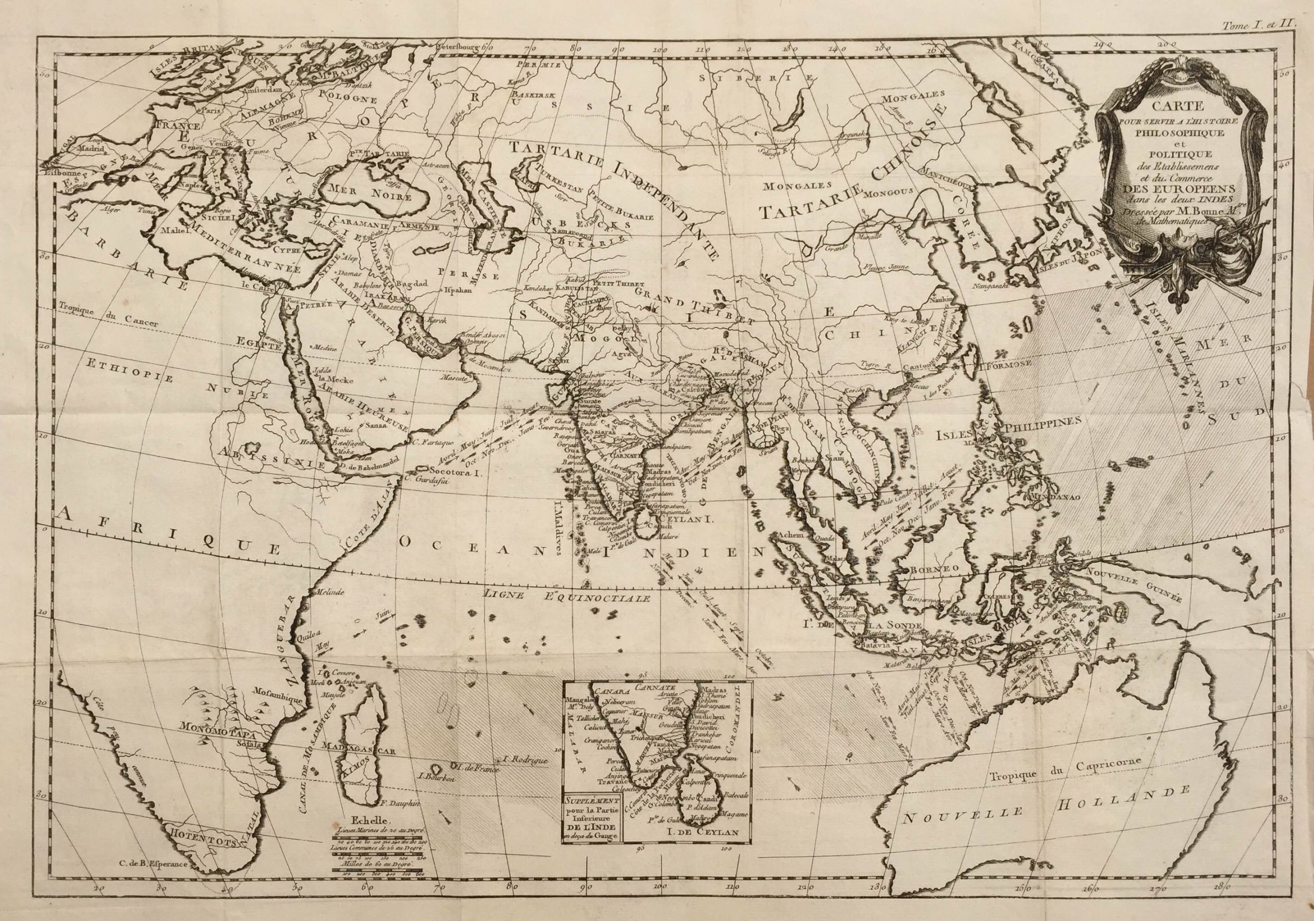
A fine and unusual late 18th century black and white French map of the eastern hemisphere from the east African coast to the East Indies and Australia showing the political divisions, the areas of commercial interest to the European powers and the directions of the prevailing monsoonal and trade winds throughout the year which dictated the sailing seasons for ships. There are also a small inset maps of southern India and Ceylon (Sri Lanka).
The map was engraved by Gaspard Andre and compiled by Rigobert Bonne (1727-1795), an engineer, mathematician and cartographer, who suceeded Jacques Nicholas Bellin as Hydrographer at Depot de la Marine, Paris in 1773. The map was originally published in G.T Raynal’s (1713-1796) four-volume Tableaux, atlas et cartes de l’Histoire philosophique et politique des établissements et du commerce des Européens dans les deux Indes in 1774 and later published in his Atlas des Deux Indes in 1780.
The folds in the map and the reference to ‘Tome I et II’ in the top right-hand corner indicate that this map is from the former publication.
Condition ; Very good condition, with a strong plate mark
Measurement ; 381 x 575 mm
Purchase code ; M1561