Subtotal: $105,00
- Selection Required: Select product options above before making new offer.
- Error: There was an error sending your offer, please try again. If this problem persists, please contact us.
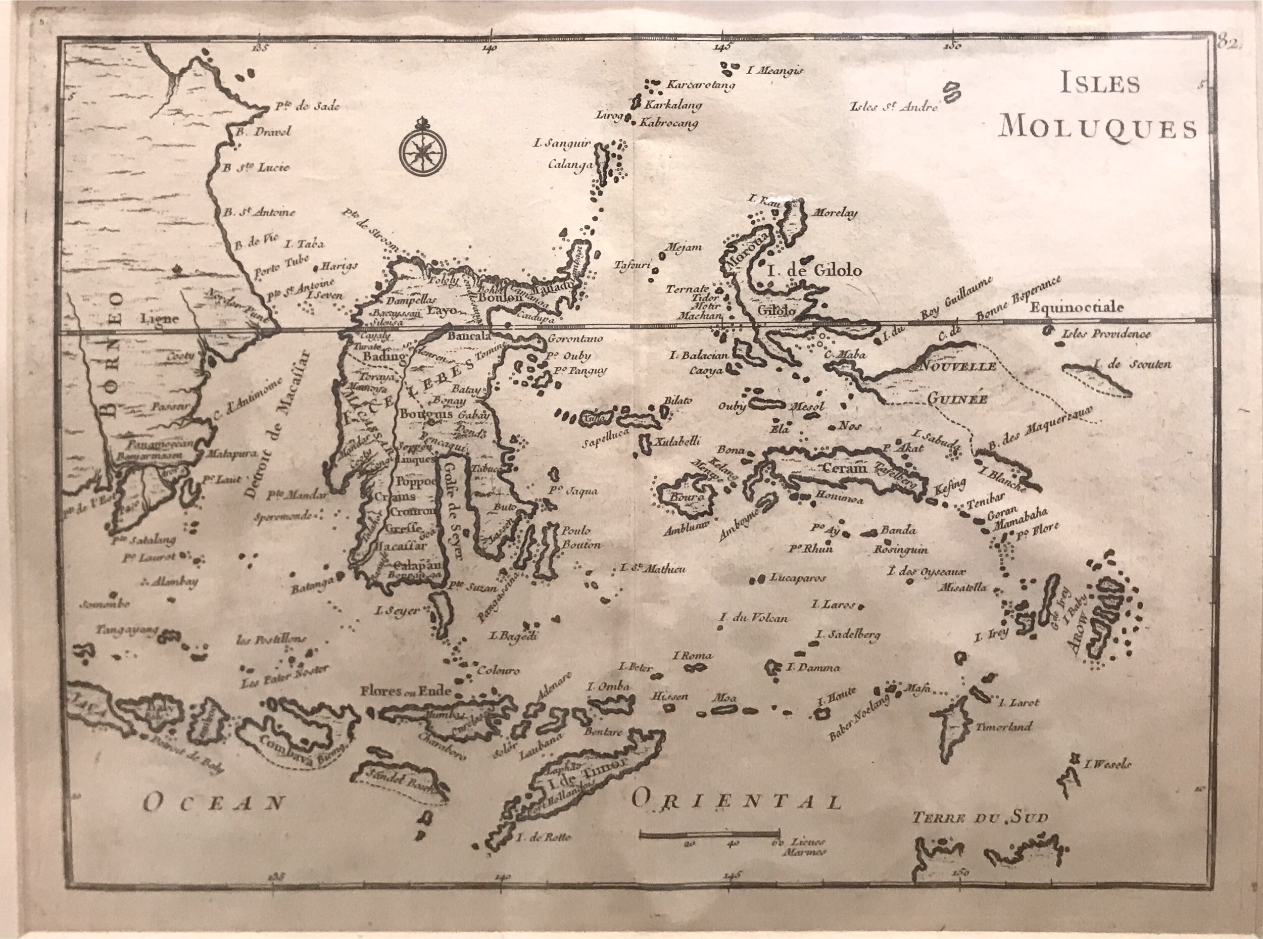
Moluccas Map – Le Rouge (c.1759)
$493,00
A relatively rare mid-18th century black and white French map of the Celebes (Sulawesi) and Molucca islands by George-Louis Rouge (1712-1790).
Out of stock
Description
A relatively rare mid-18th century black and white French map of the Celebes (Sulawesi) and Molucca islands by George-Louis Rouge (1712-1790), ingénieurs géographes du Roi and published in his Atlas nouveau portatif à l’usage des militaires, collèges et du voyageur…., a mid-18th century edition (1748-1759). The map is one of a pair with the other covering the western part of Indonesia although the Moluccas are firmly established, the map maker is less certain about the contours of New Guinea and smaller islands with their shorelines shown as dotted lines.
Conditions: Very good, with some rough paper on the right side with strong plate marks
Size in passepartout : 340 x 410 mm
Image size: 202 x 271 mm
Purchase code: M1726
Related products
-
 $3.600,00
 -
$710,00
-
$0,00
-
$2.125,00