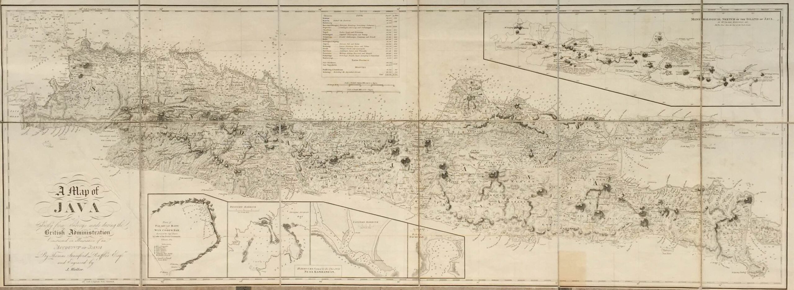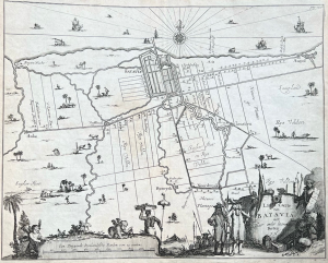

Description
‘Landt Caerte van Batavia met Haer onder hoorende Forten.J.N’
A very fine and scarce late 17th century black and white plan of Batavia and the surrounding countryside engraved by Jean Baptiste Nolin (1657-1707), a French geographer, engraver and publisher of Paris and published by Jacob van Meurs around 1682. The map is illustrated with tiny vignettes of people and animals in the fields and several ships in the harbour. The title is engraved in a cartouche as the wall of a fortress with a cannon pointing at the viewer and the initials of the engraver – J.N – included below the title.
The map is based on Johann Nieuhoff’s (1618-1672) journey to India. Nieuhoff was the official chronicles and draughtsman for the first embassy to China by the Dutch East India Company (VOC). After leaving China, Nieuhoff was offered a position in Ceylon where he was stationed from 1663-1667. Nieuhoff’s journals of his experiences in the Orient were later published in Jacob van Meurs in a book entitles Gedenkwaerdige gesantschappen der Oost-Indische maatschappy in in’t Vereenigde Nederland by Arnold Montanus (1625-1683) in 1671 with later editions.
Conditions : Very good
Measures : 302 x 381 mm
Purchase code M1819