Subtotal: $3.540,00
- Selection Required: Select product options above before making new offer.
- Error: There was an error sending your offer, please try again. If this problem persists, please contact us.
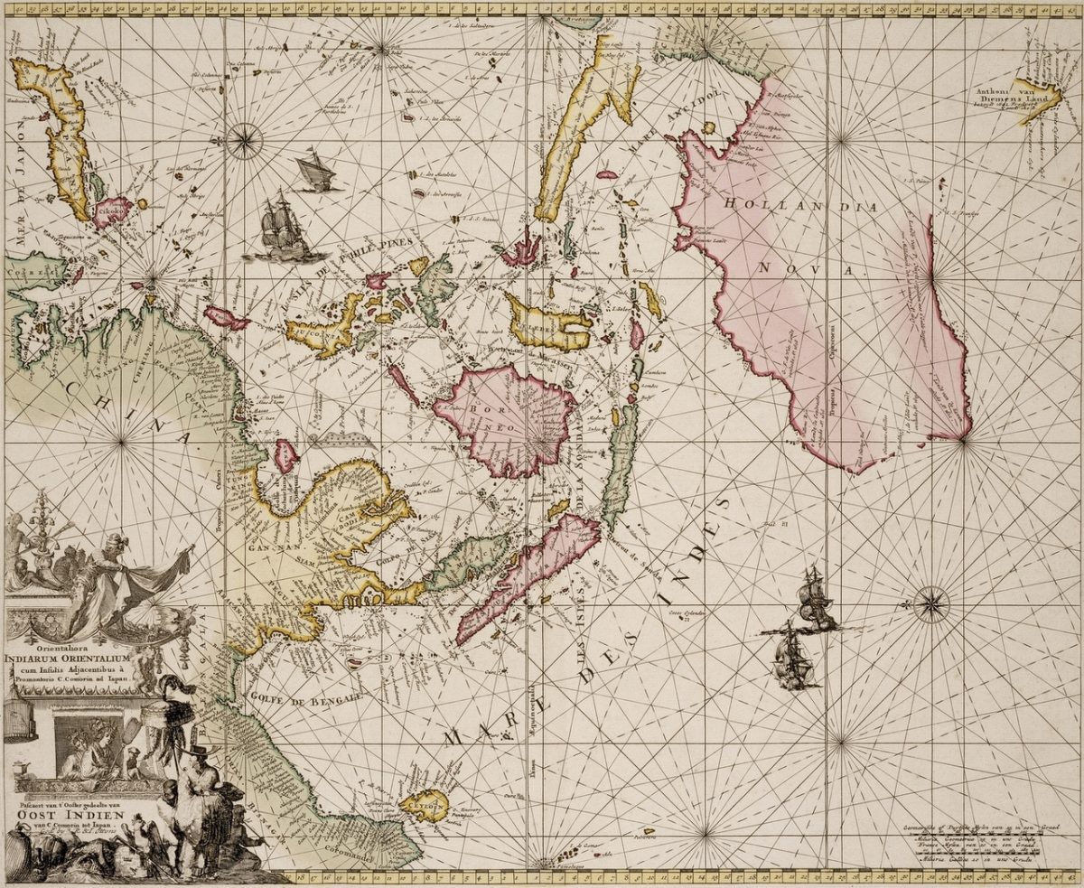
Sea Chart of East Indies and Australia – De Wit (c.1690)
$11.900,00
Description
Antique Map by Frederick De Wit titled:
‘Orientaliora Indiarum Orientalium cum Insulis Adjacentibus a Promontorio C Comori ad Iapan Pascaert van t Ooster gedeelte van Oost Indien van C Comorin tot Iapan Amsterdam’
Engraved map of the Indian Ocean, hand-colored, showing the coast of Australia and the East Indies, elaborate figural cartouche, four galleons and two compass roses. Framed (not examined out of frame).
Early Dutch sea-chart of Australia and the East Indies, based on Pieter Goos’ chart of 1666. The chart covers the region from the Indian subcontinent to Japan and includes the north eastern coastline of early Australia. Tooley, Mapping of Australia, p. 205.
- Year: 1690
- Technic: Engraving / etching on hand laid paper.
- Overall size: 31 x 26,7 inch (in frame)
- Image size: 22 x 18,5 inch
- Condition: Good, given age. General age-related toning and/or occasional minor defects from handling.
- Purchase code: MC069
Related products
-

-
$105,00
-
$550,00
-
$590,00