Antique Map East Indies by Visscher (c.1760)
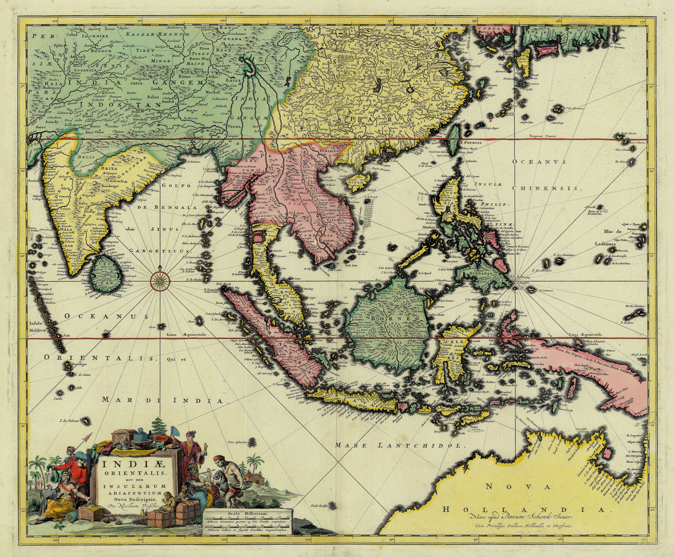
Antique Map East Indies by Visscher titled ‘INDIAE ORIENTALIS, nec non INSULARUM ADIACENTIUM Nova Defriptio, Per Nicolaum Visfcher’.
An early and relatively rare 18th century map of Southeast Asia and the east Indian Islands (Indonesia) in original colour by Nicolas Visscher II (1649-1702) originally from an edition of Visscher’s Atlas Minor published after 1682, when he was granted his patent (Cum Privilegio) and his death in 1706. This edition of the map was actually published by Petrus Schenk II (1693-1775), the son of Petrus Schenk I (1661-1711), probably in the Atlas Contractus that was re-published in 1719 after the Schenk family had acquired some of the plates from Nicolas Vissher’s stock. The map shows the same geography as that of the De Wit maps of the region published in 1662 and 1675 and shows evidence of Abel Tasman’s discoveries along the north coast of Australia in the 1640s.
Very good condition apart from some age-toning in the lower margin; measures 460 x 555 mm.
Artist: N. Visscher
Year: c.1760
Purchase Code: M1757-B
FRAMED
USD 2,550
Euro 2,300
IDR 40,000,000


