Antique Map Moluccas by Bertius (1616)
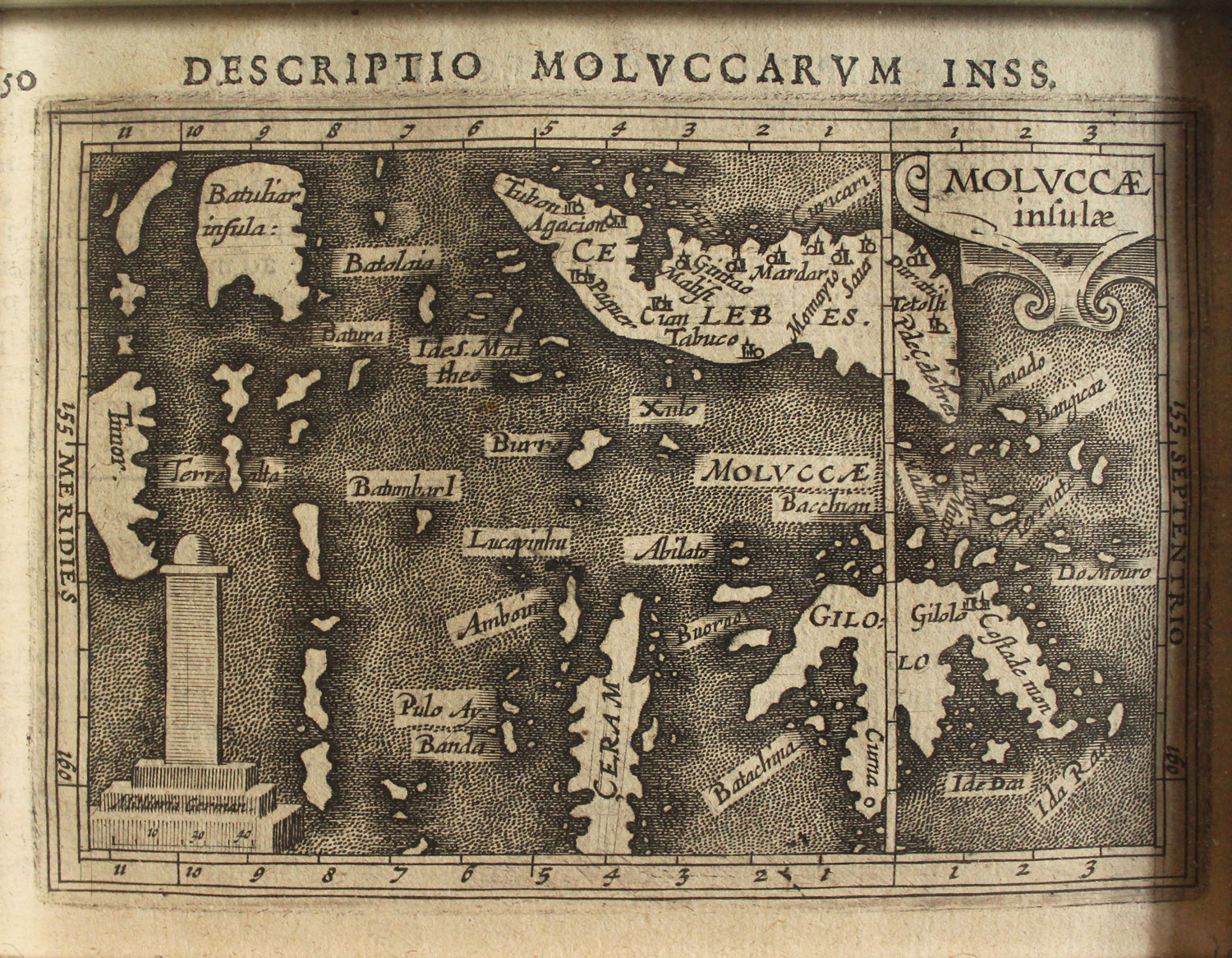
Antique Map Moluccas by Bertius titled ‘DESCRIPTIO MOLVCCARVM INSS. MOLVCCAE infulae’.
A rare early 17th century small black and white map of the Celebes (Sulawesi) and the Molucca Islands including Ceram and Gilolo (Halmahera) by Petrus Bertius (1565-1629) and published in 1616 in the pocket atlas Tabularum geographicarum contractarum, an expanded version of Barent Langenes miniature atlas, the Caert-Thresoor, that was first published in 1598. The map is orientated with west at the north and shows the clove producing islands of Ternate, Tidore, Machian and Motir just north of the equator and the nutmeg producing islands of Banda correctly located south of Ceram and Ambon.
Latin text on verso, good condition, measures 92 x 131 mm.
Purchase Code: M0567
5.800.000 IDR incl. frame
350,00 Euro incl. frame
450,00 USD incl. frame


