Subtotal: $5.725,00
- Selection Required: Select product options above before making new offer.
- Error: There was an error sending your offer, please try again. If this problem persists, please contact us.
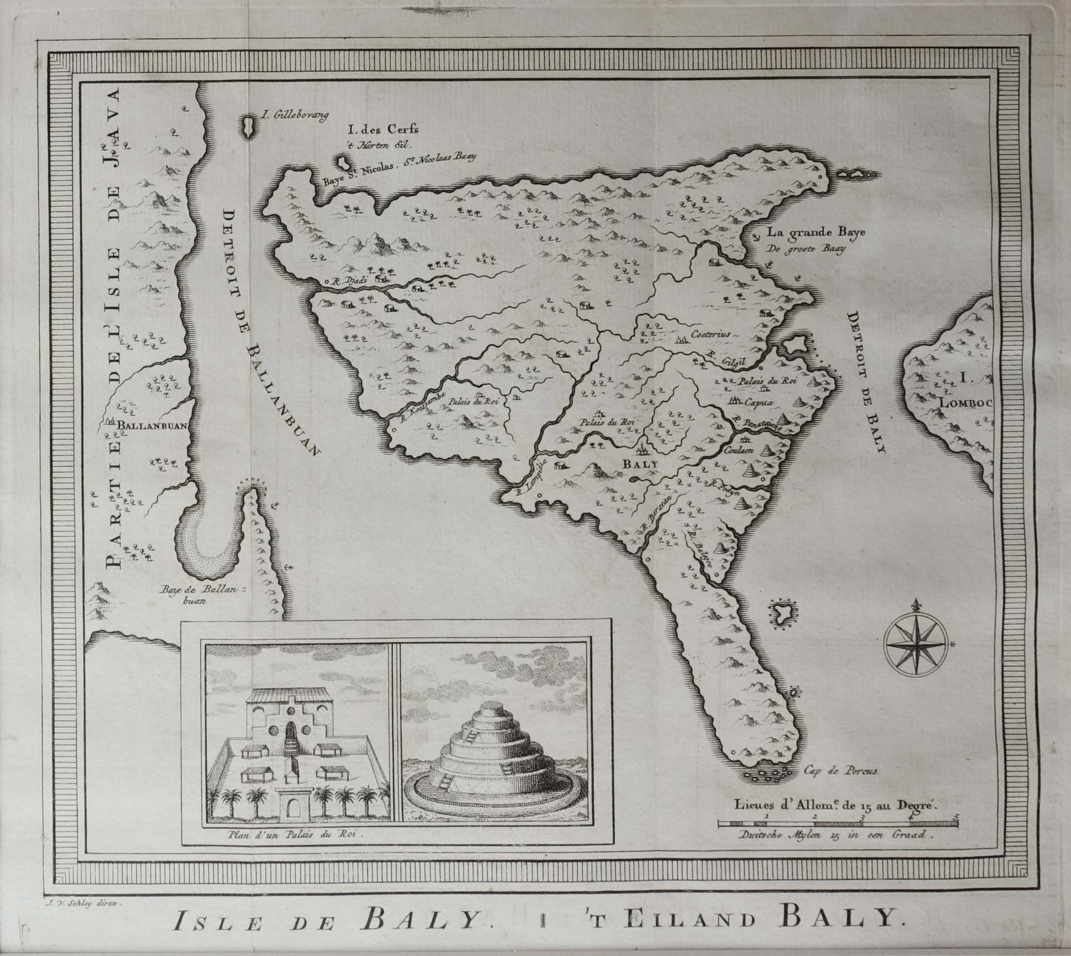
Antique Map of Bali by Van Schley (c.1770)
$235,00
Description
Antique map of Bali titled ‘Isle de Baly – ‘t Eiland Baly’. An uncommon little map of Bali with an inset of the royal palace and a Balinese temple, with a portion of the coastlines of Java and Lombok. A delicately engraved compass rose orients the map.
Jakob van der Schley (Amsterdam 1715-1779) was a Dutch draughtsman and engraver. He studied under Bernard Picart and became heavily influenced by his style.
Condition: Very good, please study image carefully.
Overall size: 36 x 33.5 cm (including passe-partout)
Image size: 23 x 19 cm.
Purchase code : M1688
3.100.000,00 IDR incl.passepartout
195,00 Euro incl.passepartout
220,00 USD incl.passepartout
Related products
-

-
$2.895,00
-
$0,00
-
$3.540,00