Description
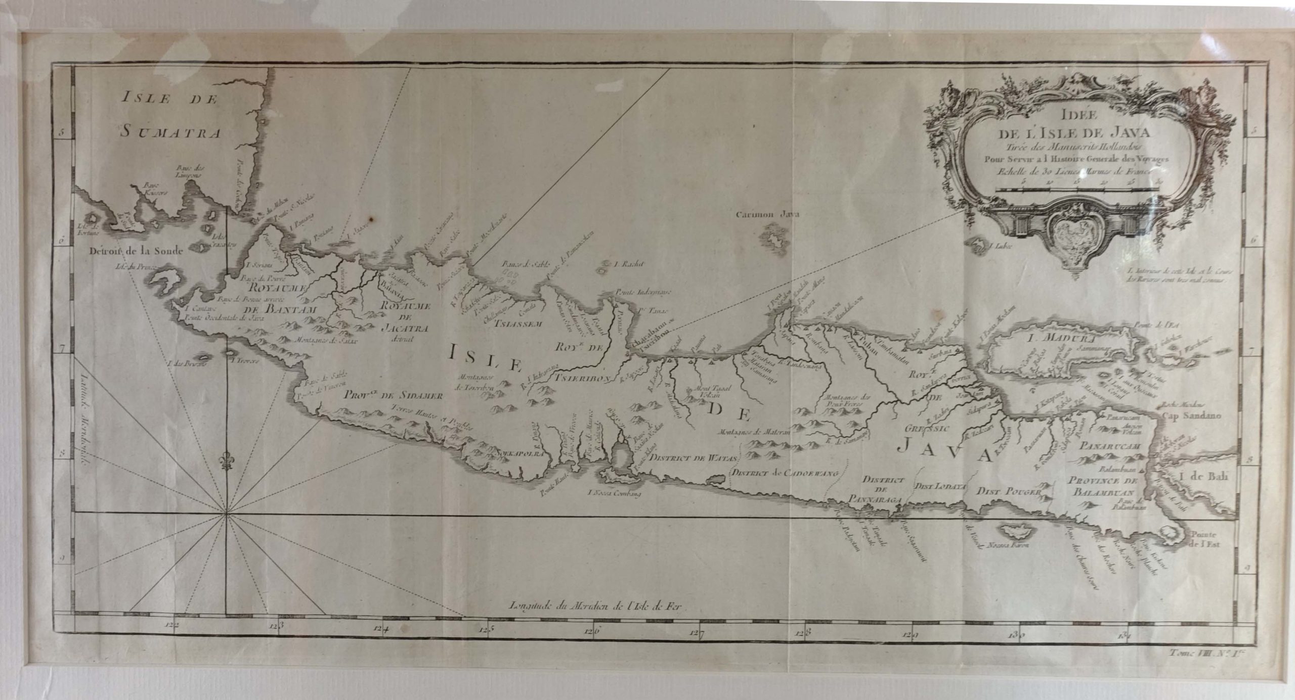
Antique map of Java titled ‘Idée de l’isle de Java’. Well engraved and attractive chart of the island shows all principal harbors and coastal details, plus rivers, mountains and volcanoes, bays, the settlements and villages, and political districts. Locates Batavia (Jakarta). Map also includes Madura Island, most of Bali, the Sunda Strait with the Krakatau Islands, and the southeastern tip of Sumatra. The island is divided into provinces and the kingdoms of Bantam, Tsieribon and Jacatra. Decorated with a very fancy rococo-style title cartouche and rhumb lines with fleur-de-lys.
Jacques Nicolas Bellin (1703 – 1772) was a French hydrographer, geographer, and member of the French intellectual group called the philosophes. Bellin was born in Paris. He was hydrographer of France’s hydrographic office, member of the Academie de Marine and of the Royal Society of London. Over a 50 year career, he produced a large number of maps of particular interest to the Ministere de la Marine.
Condition: Very good, please study image carefully.
Overall size: 56 x 34 cm.
Image size: 45 x 22,5 cm.
Purchase code : M1422
4.800.000,00 IDR (incl.passepartout)
300,00 Euro (incl.passepartout)
335,00 USD (incl.passepartout)
Please do not hesitate to contact us if you would like to receive more information about this antique print.