Description
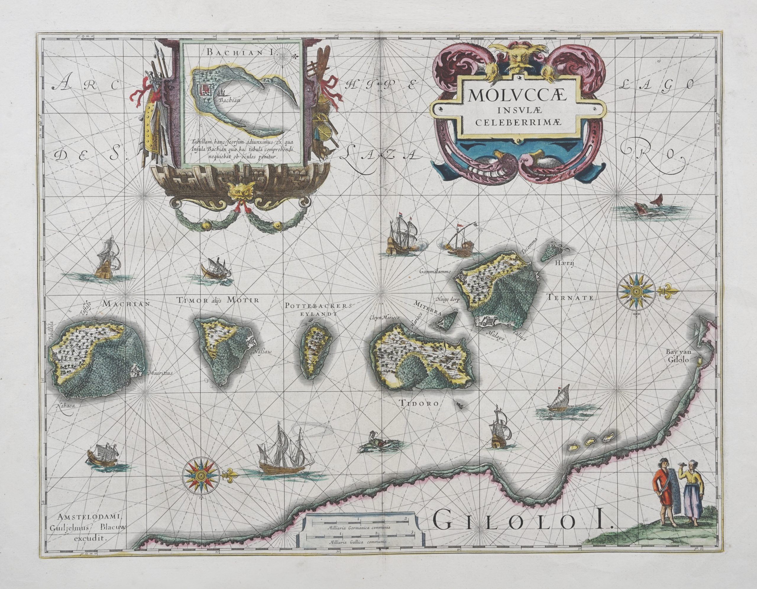
Titled ‘MOLVCCAE INSVLAE CELEBERRIMAE’.
This map is probably the best known 17th century antique map of the clove-producing North Molucca islands of Ternate, Tidore, Machian, Bachian, Motir and Potterbackers by the great Dutch cartographer William Blaeu (1571 – 1638), published in his Atlantic Appendix in Amsterdam in 1630. Jan Jansson produced a very similar map in 1633 but without the inset of Bachian Island. This edition, in modern colour was published in Bleau’s Toonel de Aerdrycx oft Nieuwe Atlas in 1635 (signature C.Koeman’s ref. Vol.1, page 105, B1.10).
Very good condition; three small worm holes on either side of the bottom centre; fold have been patched with archival hinging tape
Measures 520 x 620 mm
Purchase code M1483