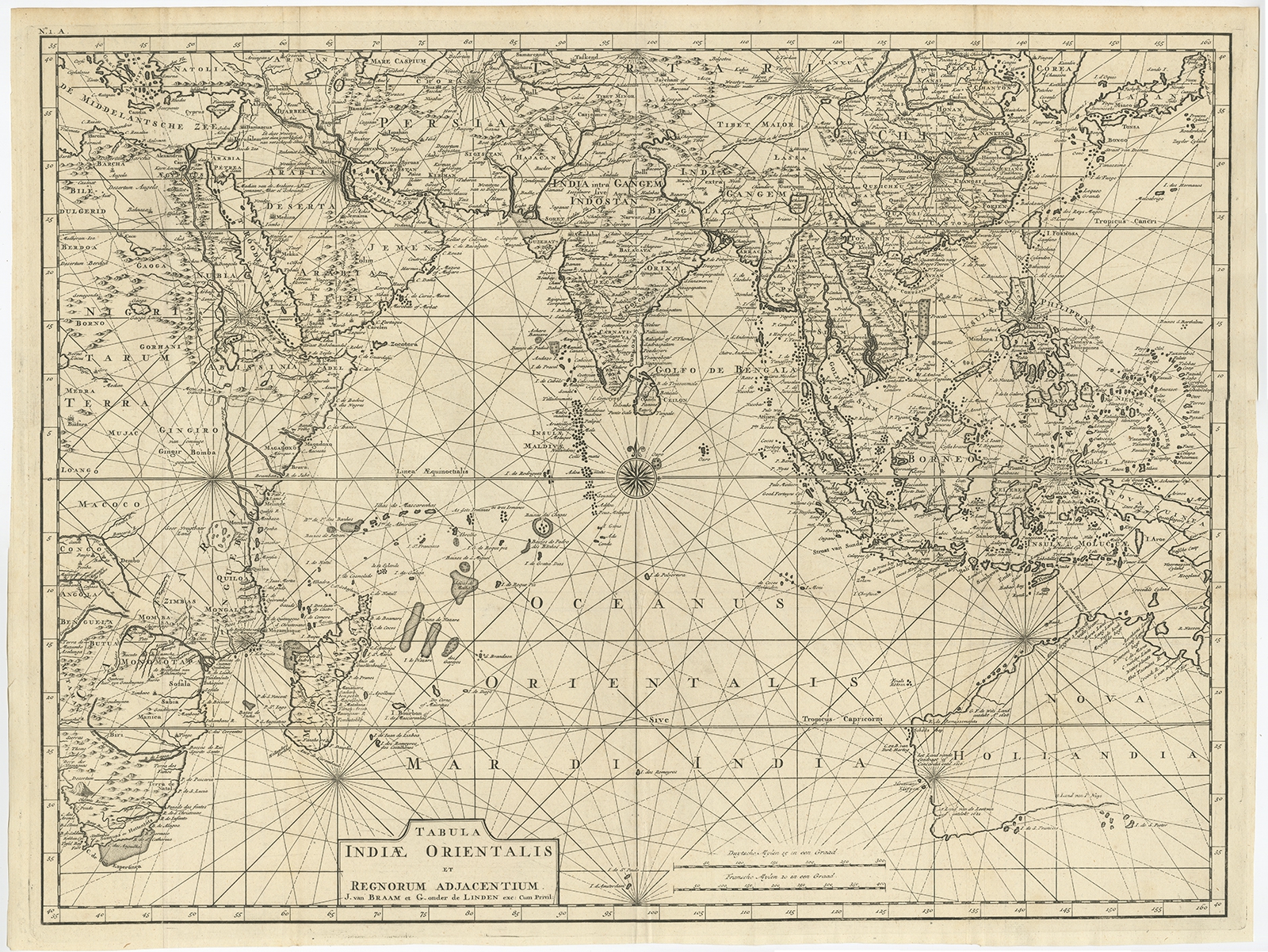
Antique Map of Southeast Asia and the Indian Ocean by Valentijn (1726)
Description: Antique map titled ‘Tabula Indiae Orientalis’. Beautiful detailed map of Australia, Southeast Asia and the Indian Ocean. The map features a fine depiction of the outlines of the western two-thirds of Australia, based on the discoveries of explorers working for the Dutch East India Company (the VOC). These include Willem Jansz’s discoveries in the Gulf of Carpentaria in 1606; the encounters of Dirk Hartog in 1616, the crew of the Leeuwin in 1622, Gerrit Frederiksz de Witt in 1627 and Pieter Nuyts in 1627, in Western Australia; and Jan Cartensz and Willem van Colster’s discoveries in northern Australia in 1623. This map originates from ‘Oud en Nieuw Oost-Indiën’ by F. Valentijn.
Artists and Engravers: François Valentijn (1666-1727), a missionary, worked at Amboina from 1684 to 1694 and 1705 to 1713 and travelled extensively in the VOC’s lands.
- Date: 1726
- Overall size: 69 x 52.5 cm.
- Condition: Good, general age-related toning. Please study image carefully.
- Purchase code: BGRN-256
- Price: 5.720,5 Euro / 6.743,5 USD / 97.500.000 IDR