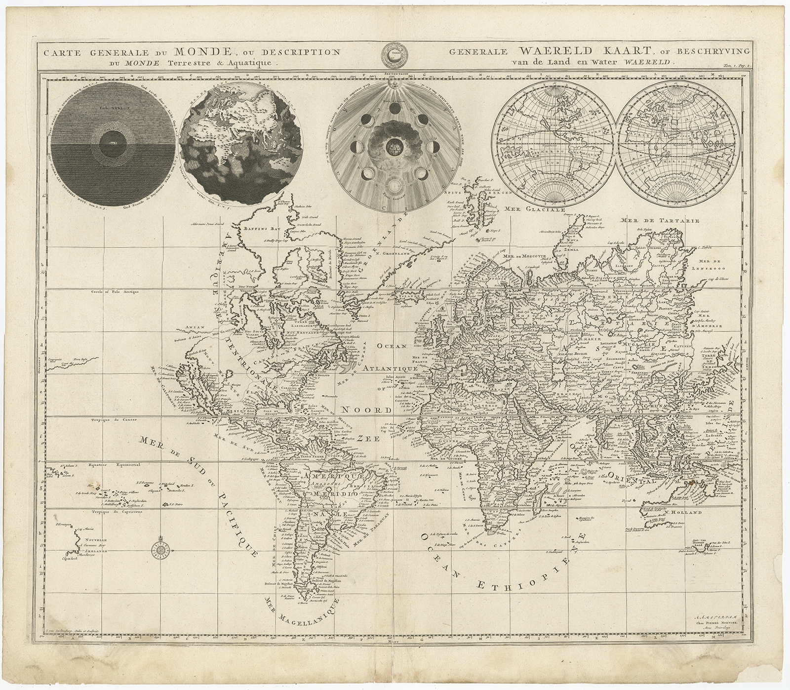
Antique World Map by Mortier (1700)
Description: Antique world map titled ‘Carte generale du monde, ou description du monde terrestre & Aquatique – Generale Waereld kaart, of beschryving van de land en water waereld’. This is Pierre Mortier’s world map drawn on Mercator’s projection. It depicts California as an island and the Detroit d’Anian connected by dotted lines through a Northwest Passage to Button’s Bay located to the west of Hudson Bay. There is an erroneous large lake shown as the source for the R. de Nort (Rio Grande River) located in the Southwest, as well as an early, open-ended version of the Great Lakes named Mer Douce. A small coastline of New Zealand appears in the Pacific. The northeast coast of Asia is severely truncated and shows Witsen’s Cap de Glaces. Australia’s northern coast is shown connected to New Guinea, and two disjointed coastlines appear to the south, including Van Diemen’s Land. The most interesting features of the map are the five spheres presented along the top depicting day and night, the flood, the phases of the moon, and the Western and Eastern Hemispheres. The map was precisely engraved by Jan van Luchenburg (imprint at lower left). This map originates from ‘Historie des Ouden en Nieuwen Testaments’ by P. Mortier.
Artists and Engravers: Pierre, or Pieter, Mortier (1661-1711) was a Dutch engraver, son of a French refugee. He was born in Leiden. In 1690 he was granted a privilege to publish French maps in Dutch lands. In 1693 he released the first and accompanying volume of the Neptune Francois. The third followed in 1700. His son, Cornelis (1699-1783), would partner with Johannes Covens I, creating one of the most important map publishing companies of the eighteenth century.
- Date: 1700
- Overall size: 51 x 43 cm.
- Image size: 47.5 x 40 cm.
- Condition: Good, some restoration on lower part and folding line. Blank verso. Please study image carefully.
- Purchase code: BG-12063-1
- Price: 833,5 Euro / 983 USD / 14.200.000 IDR