Description
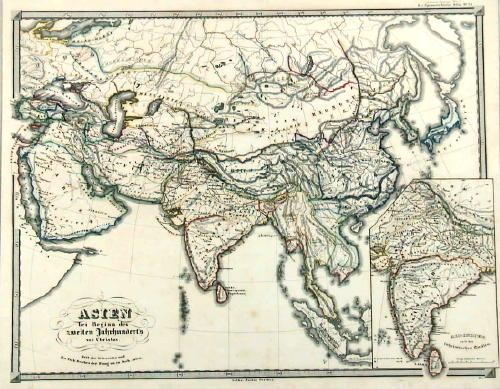
Description: Antique map Asia titled ‘Asien gegen ende des 18th Jahrhunderts. Die Briten in Indien; das Reich der Mandschu‘. This fascinating hand colored map depicts Asia at the end of the 18th century. The British had established themselves in India and the Chinese Empire was under Manchu control. Also depicts Southeast Asia in good detail with early versions of Vietnam (Anam & Tonkin), Cambodia (Kambodscha) and Thailand.
Artists and Engravers: Karl Spruner von Merz (15 November 1803 – 24 August 1892), or Karl von Spruner as he preferred to be known, was a German cartographer and scholar. He is best known for his historical atlases. The first of these was his Historischer Atlas von Bayern (historical atlas of Bavaria), published in 1838. His greatest work was his Historisch-Geographischer Hand-Atlas, whose first edition appeared in parts from 1848 to 1853.
- Date: 1853
- PartNumber: 232
- Storage Location: (BG) B3-20
- Purchase code: PCT-232
- Price: 57,5 Euro / 68 USD / 980.000 IDR