Description
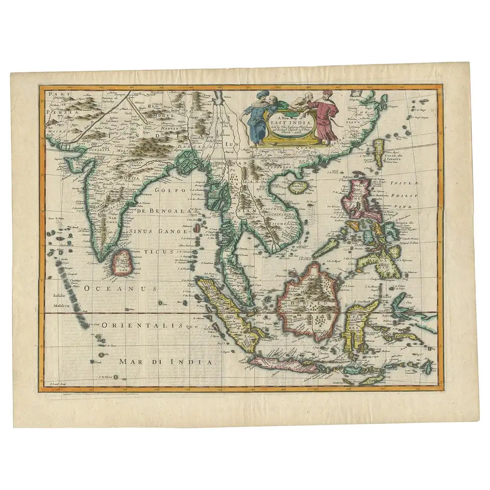
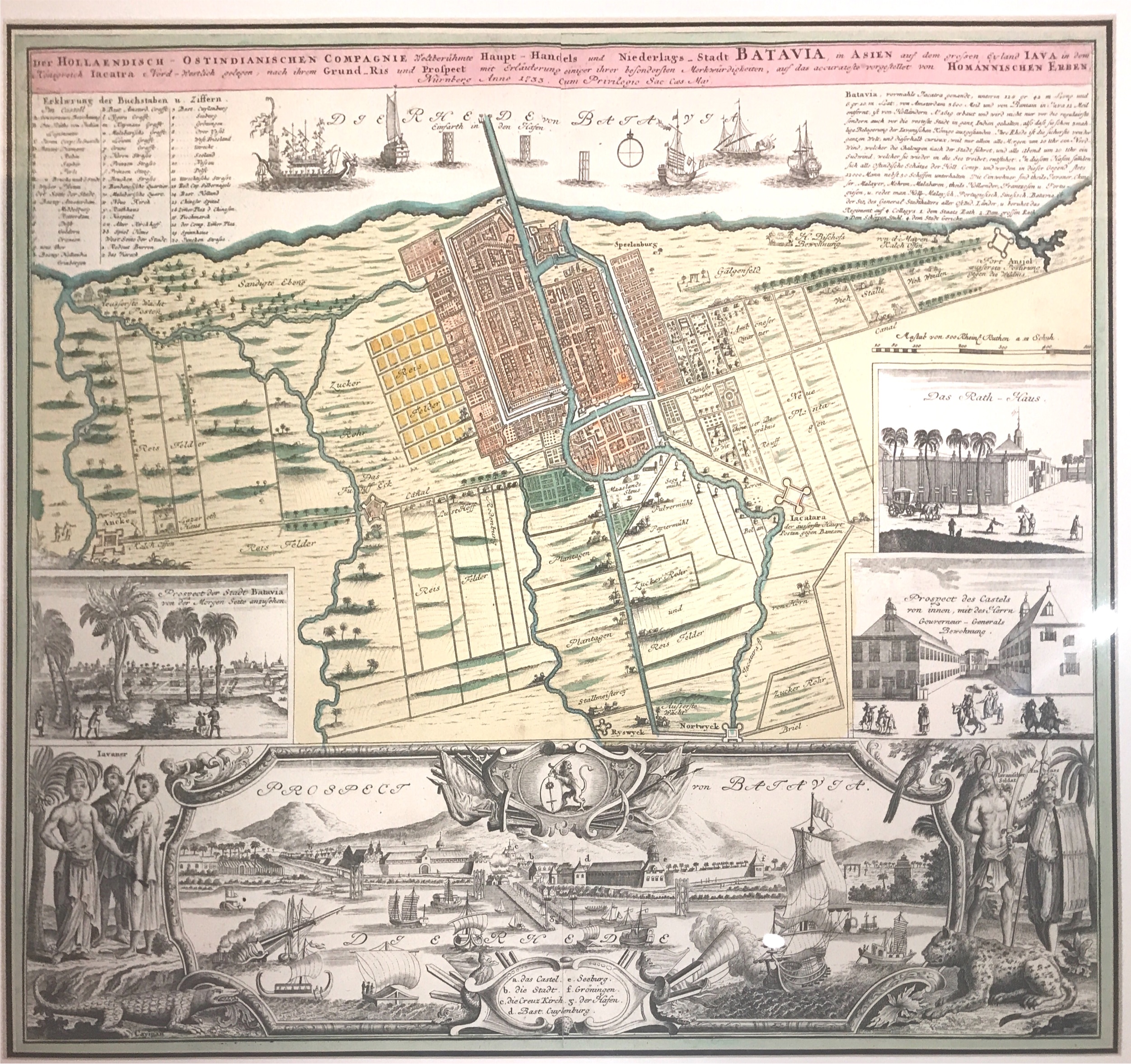
Antique Map Batavia by Homann titled ‘Batavia / Der HOLLAENSISCH – OSTINDIANISCHEN COMPAGNIE Weltberuhmte Haupt – Handels und Niederlags – Stadt BATAVIA, in ASIEN auf dem grofsen Eyland IAVA in dem (..)’.
A very attractive and much sough-after mid-18th century large German map of Batavia in colour by the Heirs of Johann Baptist Homann known as Homannische Erben (1684-1760) and published in the Homannischer Atlas around 1747 although the original map was compiled in 1733. The plan shows the city and its immediate environs, the surrounding rice fields intersected by a network of waterways, canals and outlying fortifications. A detailed lettered key identifies the buildings and sites of importance of this capital and administrative centre of the Dutch East Indies. Inset views depict the city, Rathaus and the castle, whilst below there is a full-length panorama of the city from the sea embellished on each side by portraits of native Javanese figures and exotic wildlife including a leopard and a cayman. Homann Heirs maps tended to be coloured whereas the cartouches and insets were left uncoloured. Much of the information in the map is derived from the accounts and illustrations of the mid-17th century Dutch traveler Johann Nieuhoff.
- Date: 1744
- Technic: Engraving/etching on hand laid paper.
- Overall size: 30,3 x 26 inch (in FRAME)
- Image size: 21,6 x 18 inch
- Condition: Good, given age. General age-related toning and/or occasional minor defects from handling.
- Purchase code: BG-04706