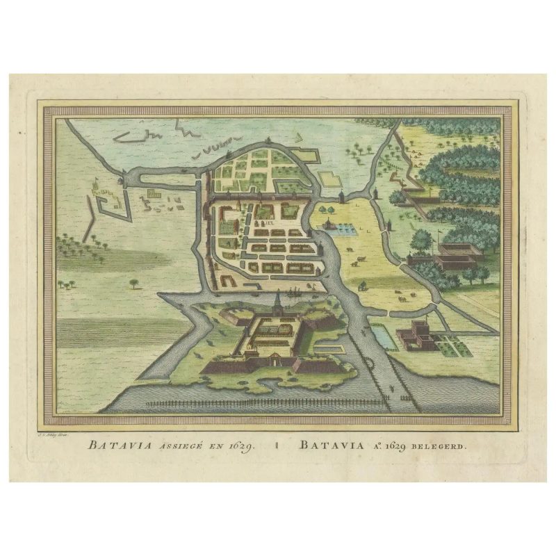
Bird’s Eye View of Batavia – Van der Schley (c.1763)
Antique maps of a bird’s-eye view plan of Batavia, the historical name for Jakarta, Indonesia, dating back to 1763.
The map was crafted by Jakob van der Schley / P.de Hondt and is a fine example of cartographic detail and artistry from the 18th century. It depicts the city’s layout and fortifications with precision, offering insight into the urban design and colonial fortifications of the time. The map is hand-colored and showcases the geographical features and man-made structures with clear demarcations. The streets, buildings, and city walls are illustrated from an elevated perspective, providing a comprehensive overview of Batavia as it existed in the mid-1700s, during the period when it was a bustling hub under Dutch colonial rule.
Condition : Good, minor wear and light fading due to age and handling, but mostly out of the plate-mark. One vertical flattened folding line.
Mesures : 280 mm x 330 mm
Purchase code : BG-13484-9