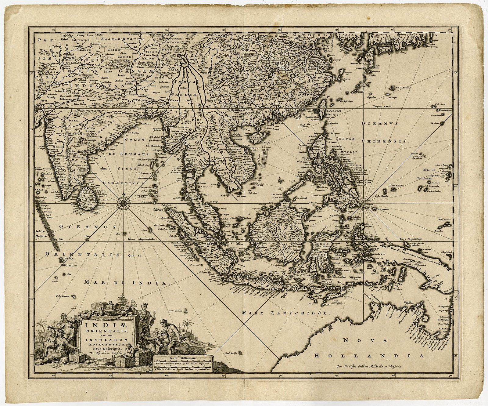
Description
Description: Antique Map, titled: ‘Indiae Orientalis, nec non Insularum Adiacentium Nova Descriptio.’ – Map of Southeast Asia. The map centers on the Strait of Malacca and Malay Peninsula. It extends from India and the Maldives in the west to New Guinea and the southern coast of Japan in the East. Decorative title caartouche in the lower left.
Published by Nicolaes Visscher in Amsterdam, c. 1670. This map was also published in Atlasses by Janssonius.
Artists and Engravers: Made by an anonymous engraver after ‘Nicolaes Visscher II’. The Visscher family were art and map dealers in Amsterdam during the 17th century. Funded by C. J. Visscher (1587-1652), the business was continued by his son and grandson both named Nicolaes. Nicolaes Visscher I was born 1618 in Wenns, Austria. He died 1679 in Linz. Nicolaes Visscher II (Amsterdam; 1649-1702). After the death of Nicolas II, his widow passed the business to Pieter Schenk.
- Date: 1670
- Technic: Engraving on hand laid paper.
- Overall size: 24,9 x 20,6 inch
- Image size: 22,4 x 18,3 inch
- Condition: Good, given age. Original middle fold, as issued. A long vertical printer’s crease from the lower margin into the middle of the sheet. Top and right edges a little browned and with small tears. Two binding holes in the left margin. Dampstained in the top left margin. A few faint stains in the image, a faint larger stain in the top edge of the image. Nice well inked ed. General age-related toning and/or occasional minor defects from handling. Please study scan carefully.
- PartNumber: PCT-56792
- Storage Location: BG-B3-09
- Price: 1.197,5 Euro / 1.400 USD / 20.460.000 IDR