Description
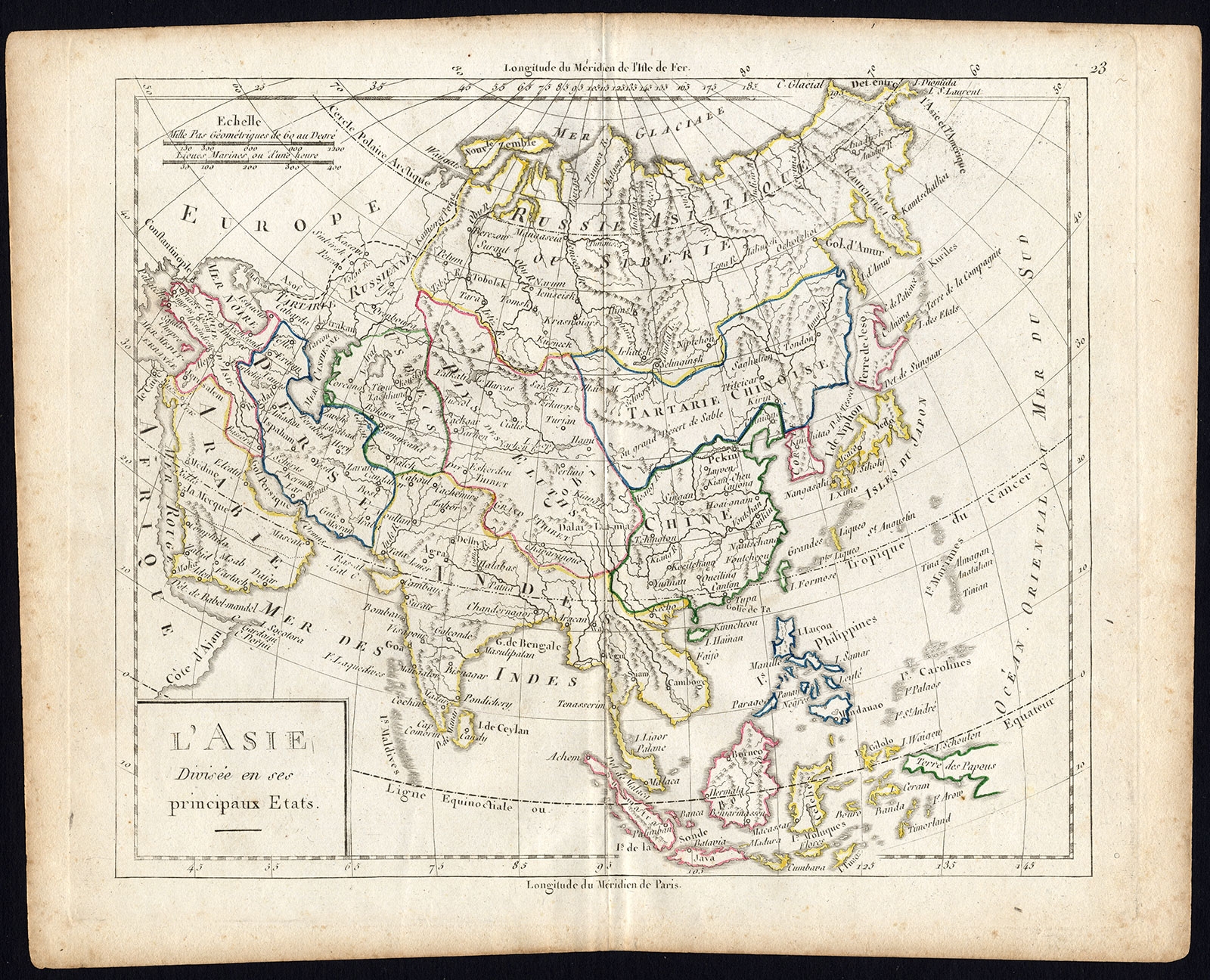
Description: Map: ‘L’Asie divisee en ses principaux Etats.’ (Map of Asia and its principal states). This map originates from an Atlas by Didier Robert de Vaugondy or his successor De Lamarche, published ca. 1785.
Artists and Engravers: Gilles Robert de Vaugondy (1688�1766), also known as Le Sieur or Monsieur Robert, and his son, Didier Robert de Vaugondy (c.1723�1786), were leading mapmakers in France during the 18th century.
- Date: 1785
- Technic: Engraving and etching on a verge type hand laid paper. Outline hand colour.
- Overall size: 11 x 8,7 inch
- Image size: 9,1 x 7,7 inch
- Condition: Good. General age related toning and light staining. Original fold line from binding as issued. Please study scan carefully.
- PartNumber: PCT-35341
- Storage Location: (BG) A221-12
- Price: 112,5 Euro / 132 USD / 1.900.000 IDR