Description
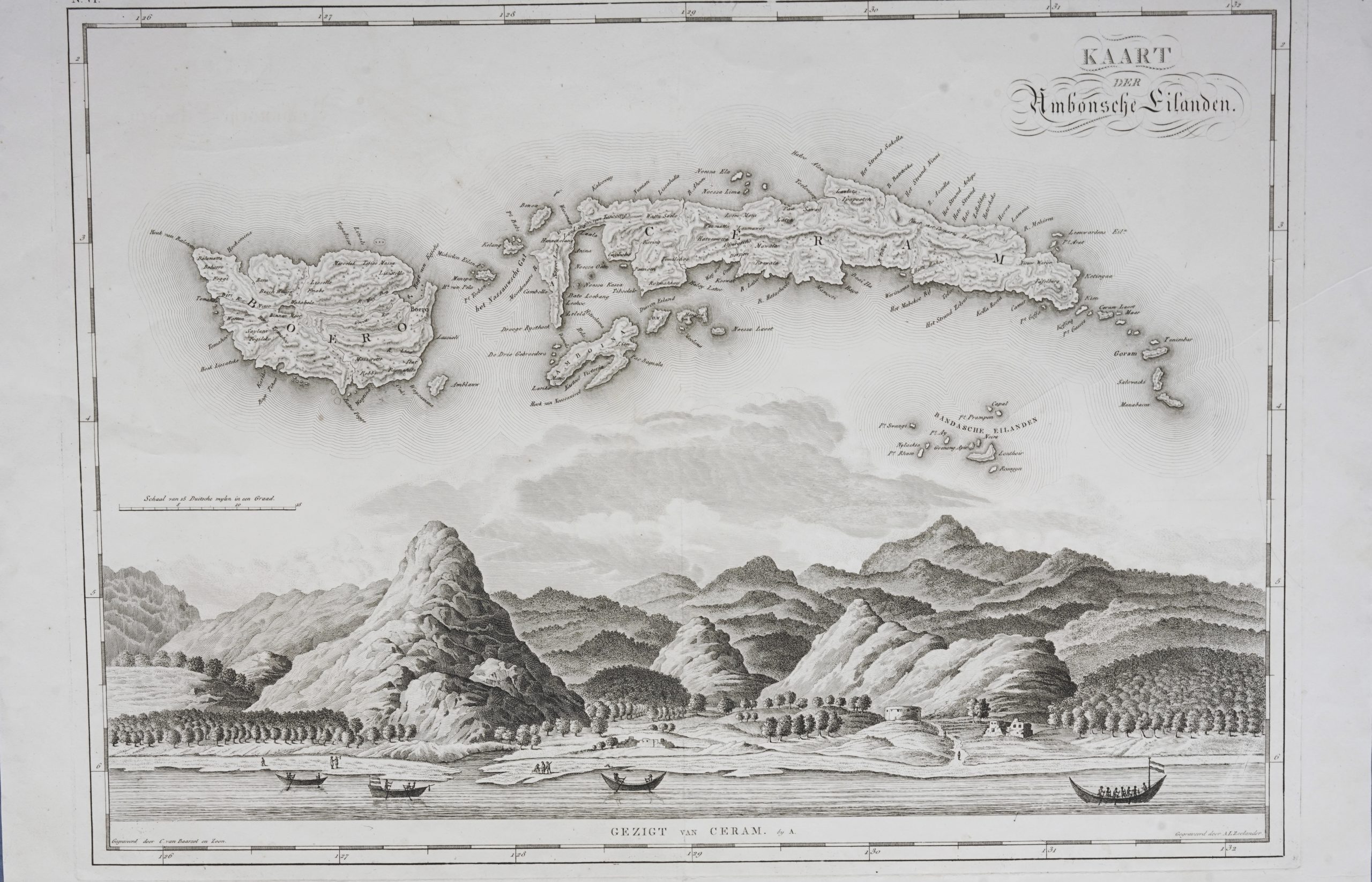
‘Kaart der Ambonsche Eilanden gezigt van Ceram’
An attractive early 19th century (1818) original black and white Dutch map of Ambon, Ceram, Boero (Buru), and the Banda islands in the Moluccas (Maluku) with a fine engraving of the coast of Ambon showing the hills and mountains and groves of trees (possibly Kenari nut trees) along the shoreline. The map was engraved by Cornelis van Baarsel (1761-1826) and son (William Cornelis van Baarsel 1791-1854) with the coastal view engraved by A.L Zeelander and published in the atlas that was part of the publication of ‘Nederlandsche Bezittingen in Azië, Amerika en Afrika, in derzelver toestand en aangelegenheid voor dit Rijk, wijsgeerig, staatshuishoudkundig en geographisch beschouwd’ 1818 by Baron Johannes (Jan) van den Bosch (1780-1844) of the Hague and Batavia, a Major General, Knight of the 3rd Class of the Military William Order,.
The atlas consisted of 12 maps of the Dutch overseas colonies including nine of the Dutch East Indies (Indonesia), one maps of Surinam, one of Curacao, and one of Guinea. Two editions of Atlas der Overzeesche Bezittingen.. were published by Gebroeders van Cleef in Amsterdam between 1817 and 1818 in Dutch. This was the first atlas to cover the Dutch East Indies after the territories were handed back to the Dutch following the defeat of Napoleon at Waterloo in 1815 and the end of the British administration in Java under Stamford Raffles in 1816. The map, number VI, is one of 12 maps from Atlas der Overzeesche Bezittingen.. (Atlas of Oversea Possessions) in 1818.
Condition : Very good, apart from small vertical tears in the bottom margin (repaired with tape) ; strong plate mark
Measurements : 595 x 498 mm
Purchase code : M1817