Description
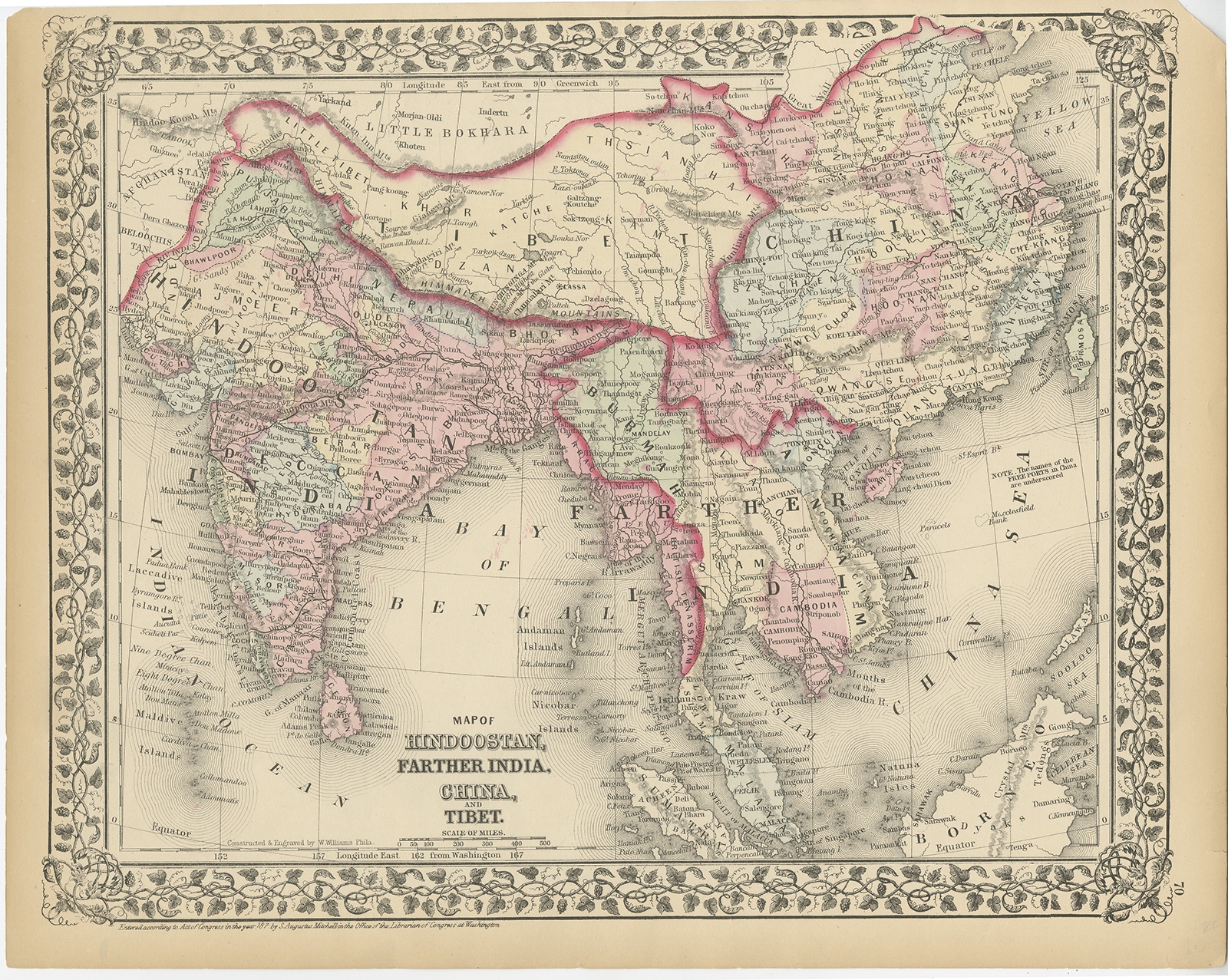
Description: Antique map titled ‘Map of Hindoostan, Farther India, China and Tibet’. Map of India and Southeast Asia, including Cambodia, Siam, Burmah, Tonquin, Cochin China, British Tenasserim. Shows roads, towns, rivers, mountains, etc. Originates from Mitchell’s ‘New General Atlas’.
Artists and Engravers: Published by S. Augustus Mitchell, Philadelphia.
- Date: 1874
- Overall size: 33.5 x 30.5 cm.
- Image size: 35.5 x 29 cm.
- Condition: Good, age-related toning. Few marginal tears, please study image carefully.