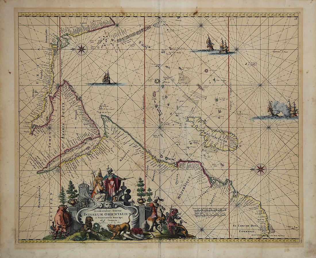
Description
Original title ‘Occidentalior Tractus Indiarum Orientalium…’
A rare and attractive sea chart of the Indian Ocean and East Coast of Africa in the 17th century, an excellent example of a sea chart by a well-known Dutch cartographer in the second half of the 17th and 18th century, Frederik De Wit (1629-1706).
This map shows the coasts, islands and hazards encountered by ships trading route between Europe and Asia.
Good condition; apart from brownish age-toning on the edge of the paper and strong platemark ; small tear at the edge
Measurements 540 x 621 mm
Purchase code BG-04740