Description
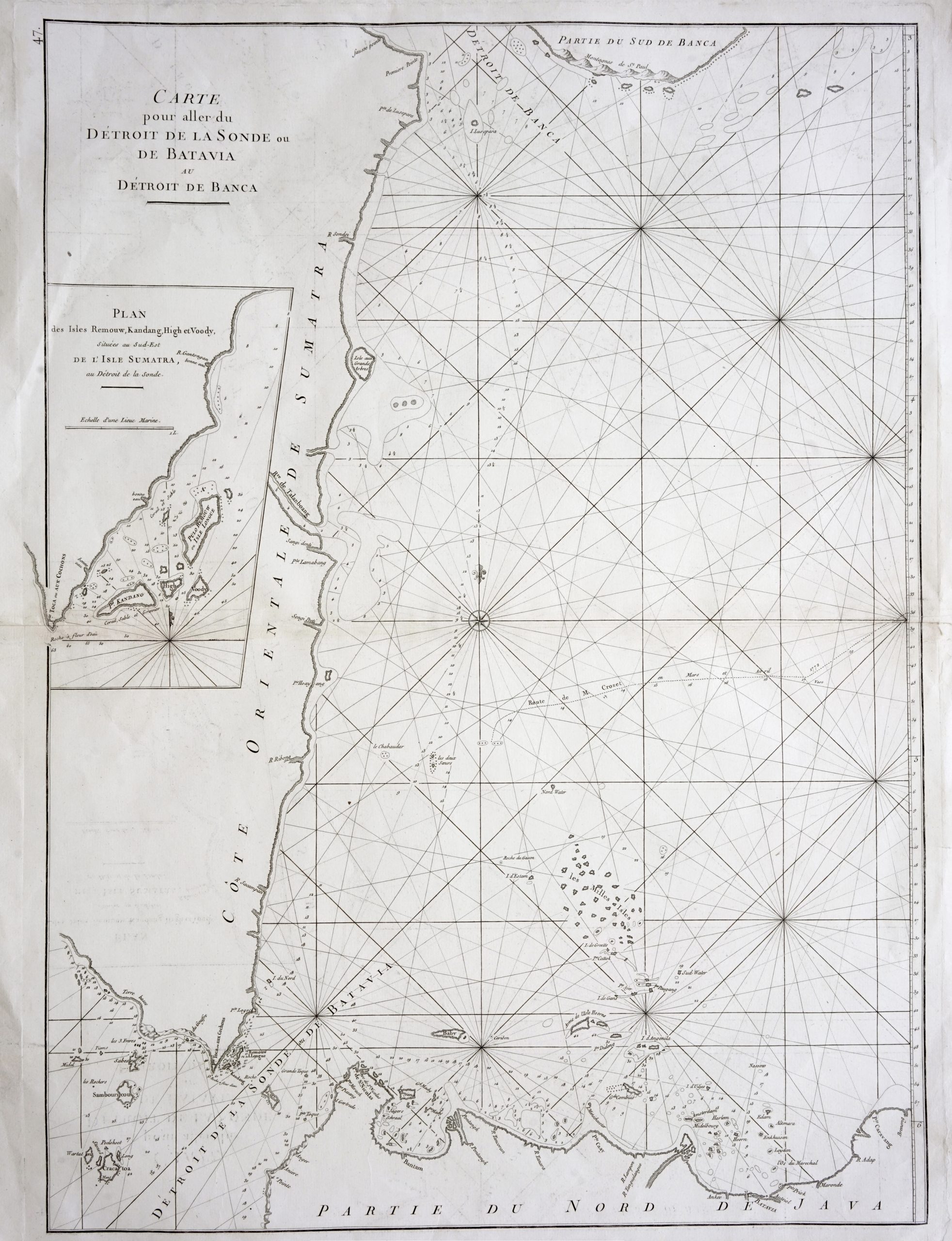
Titled “Carte pour aller du Détroit de la Sonde ou de Batavia au Détroit de Banca”
An uncommon late 18th century black and white French sea chart showing the coast of northern Java and eastern Sumatra and the Sunda Strait together with an inset map of the small islands of the south-east tip of Sumatra by D’Apres de Mannevillette (1707-1789), a famous French hydrographer who corrected the latitudes of many places in the Far East using new instruments during a voyage to China in 1728.
When the first edition of his atlas Le Neptune Oriental was published in 1745, it was regarded as a major achievement and an indispensable aid to navigators. The chart also shows the route of Julien Crozet in April 1772, who led a French expedition to the South Pacific after the voyage’s commander Marion de Fresne and 26 crew members were killed (and allegedly eaten) by a Maori tribe in the Bay of Islands off the coast of New Zealand. This chart is from a later edition of the Le Neptune Oriental that was published around 1775.
Excellent condition with a strong plate mark apart from a small horizontal tear along the right-side centre-fold margin.
Measurements 550 x 755 mm
Purchase code M1429