Description
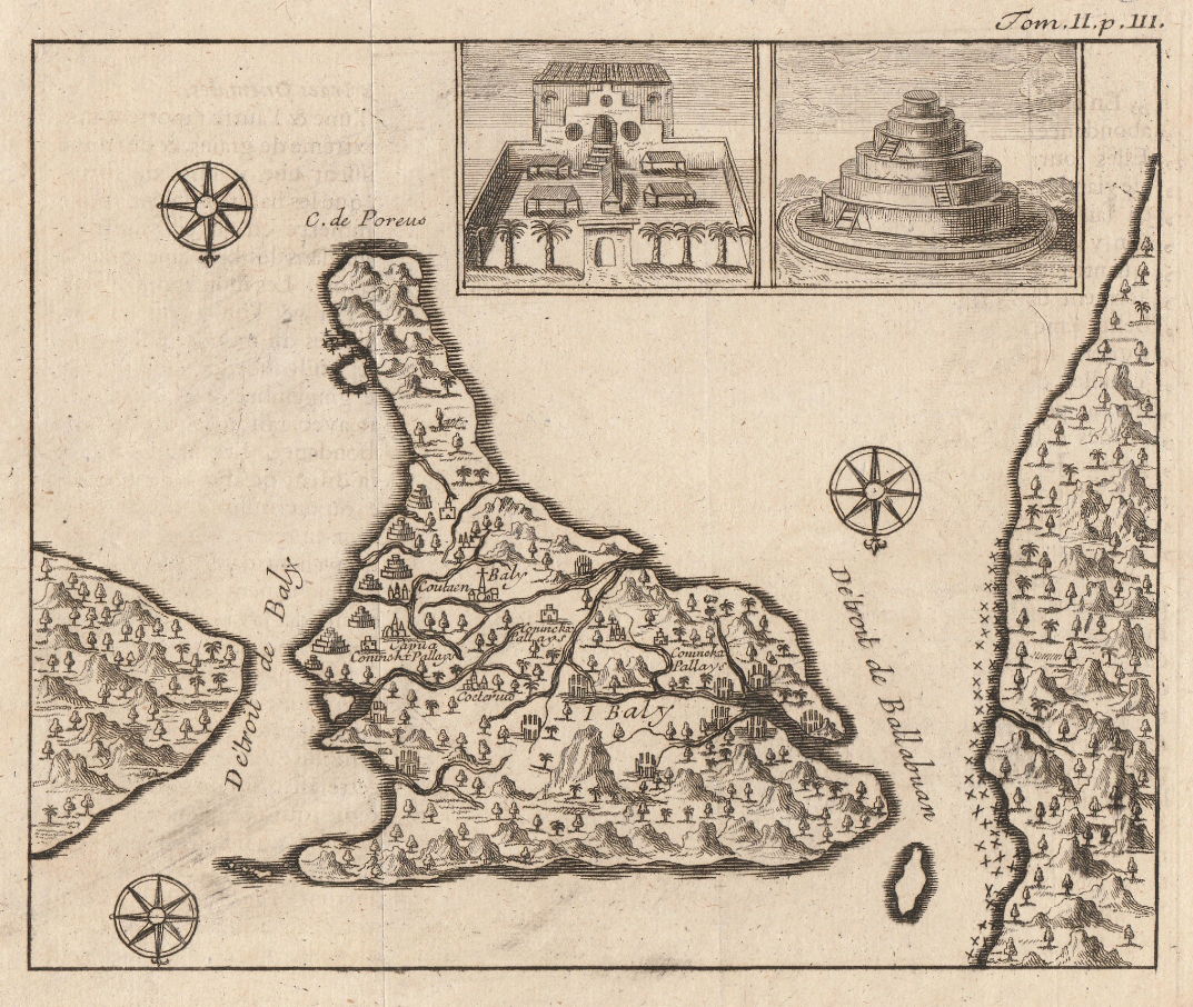
Antique Map of Bali Island titled ‘Détroit de Baly’.
An attractive small black and white mid-18th century map of Bali with Inset of “Plan d’un Palais du Roi”. by Jacques Nicolas Bellin (1703-1772), who spent more than 50 years at the French Hydrographic Service where he was appointed the first Ingénieur hydrographe de la Marine and was commissioned to carry out new surveys, first of the coasts of France and then of all the known coasts of the world. Engraved by Jacob van der Schley (1715-1779) and published in A.F. Prévost’s Histoire générales des Voyages in Paris between 1747 and 1775. Although the map detail is similar to that found on the early 17th century map of Bali by Theo De Bry in an edition of the Petits Voyages that was, in turn, based on the earlier map of Bali compiled by Willem Lodewijcksz, a member of Cornelius de Houtman’s pioneering voyage to the East Indies in 1595-97. The orientation of this map has north pointing south in order to have the two small insets the right way up.
Condition: Very good
Measures: 133 x 159 mm.
Purchase Code: M1774