Description
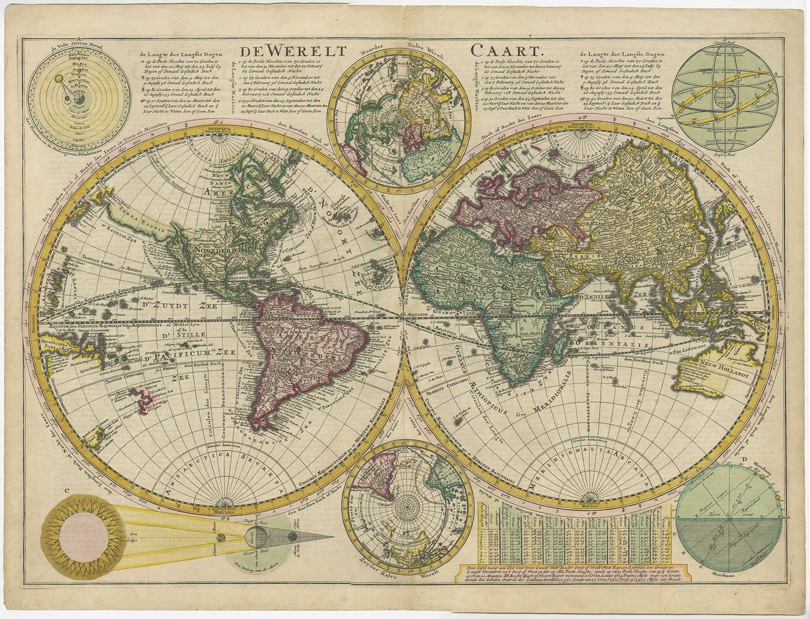
Description: Antique world map titled ‘De Werelt Caart’. Double hemisphere world map showing Australia as Niew Hollandt and according to the discoveries made by Abel Tasman on his two voyages in 1642-44. California as an island and the north west coast of America is named Terra Esonis. In Asia, Korea is a elongated peninsula. The two main hemispheres are surrounded by six smaller spherical sections, two covering the polar surfaces of the earth, two showing astronomical measurements relative to the earth, one featuring a geocentric view of the solar system and the other representing the Sun and its relationship with both the Earth and the Moon showing how eclipses are produced. Originates from a Dutch bible.
Artists and Engravers: Made by or after C. Danckerts.
- Date: c.1720
- Overall size: 54.5 x 41 cm.
- Image size: 51.5 x 36.5 cm.
- Condition: Very good, original/contemporary hand coloring. Dutch text on verso, please study image carefully.