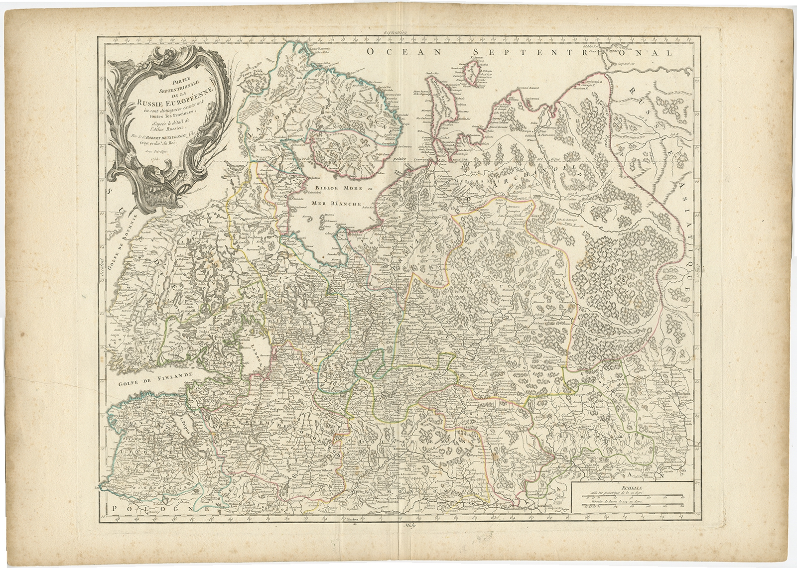
Antique Map of Russia in Europe by Vaugondy (1753)
Description: Antique map titled ‘Partie septentrionale de la Russie Européenne’. Detailed map of the Northwestern part of Russia, from the Gulf of Finland and Poland, to the western part of Asian Russia.
Artists and Engravers: Gilles Robert de Vaugondy (1688-1766) was the head of a leading family of geographers in eighteenth century France. Gilles got his start when he jointly inherited the shop of Pierre-Moullart Sanson, grandson of the famous geographer Nicholas Sanson. The inheritance included the business, its stock of plates, and a roller press. In 1760 Gilles became geographer to King Louis XV. His son, Didier Robert de Vaugondy (ca. 1723-1786), was also a geographer and the two worked together. They were known for their exactitude and depth of research. In 1757, they produced the Atlas Universel, considered an authority for many years.
- Date: 1753
- Overall size: 77 x 55 cm.
- Image size: 59 x 48 cm.
- Condition: Good, general age-related toning. Minor wear, please study image carefully.
- Purchase code: BG-12183-1
- Price: 214,5 Euro / 253 USD / 3.650.000 IDR